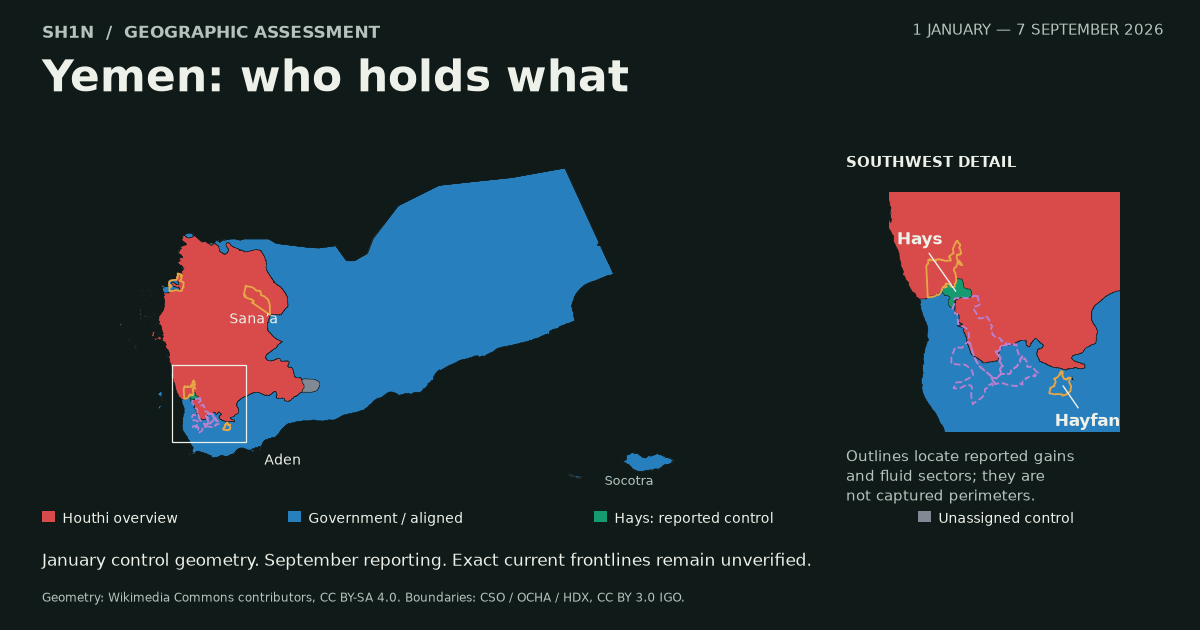
Government forces are reported to have captured Al-Labnat (Labanat) camp in Al-Jawf on 7 September. Completed-capture accounts followed the earlier encirclement and partial-entry reports. MarebPress also reports a named Nation Shield commander saying the forces had passed the camp and continued advancing. The camp’s reported fall extends the latest government gains into Al-Jawf. Al-Wattan, Ajel, MarebPress.
The other clearest recent loss reports concern Hays in southern Al Hodeidah and the heights around Al-Mafalis in Hayfan, southern Taiz. Western Taiz is moving in both directions: a Houthi breakthrough on the Taiz–Mokha road was followed by government recoveries. Saba: Hays, Saba: Hayfan, Yemen Monitor.
Latest evidence check: 7 September 2026, 15:27 Yemen / 1227Z. Al-Labnat has been updated to reported government capture; the earlier reports remain in the source chronology.
Assessment: 1 January–7 September 2026. The map below separates the broad control picture from the places where fresh gains are being reported. Every mapped report carries its source, date and geographic limits. The dated January colors stay visible beneath the report outlines; a local battle does not erase the historical control of an entire district.
January’s big government gains were against the STC
The first correction matters for the entire map. Government forces recovered large areas of southern and eastern Yemen in January from the Southern Transitional Council. Counting those areas as Houthi losses would give the wrong starting point. ACLED, 9 February.
The Houthi–government front was much less mobile through the first half of the year. Sana’a Center’s January–March review describes largely unchanged lines. Its April–June review finds no significant territorial exchange; the same review’s update also records no significant gains from the 3–6 July fighting in Hudaydah. These are regional assessments. A hill or checkpoint can change hands without moving that national picture. January–March review, April–June review.
By 19 August, ACLED was reporting more clashes and strikes, but no serious push by either side to take territory. There were local reversals: two Hayfan positions reportedly fell briefly to the Houthis on 12–13 August and were recovered. That sequence establishes a recovery, not an additional gain over January’s position. ACLED, Al-Mashhad.
Hays: the city was already government-held
Hays is the clearest district-level case in the September reporting. On 5 September, the government’s Saba news agency said the armed forces and Joint Forces had secured the district’s countryside. Its statement explicitly says Hays city was already under their control. Saba.
The change concerns the rural belt and surrounding positions. Reports name Wadi Nakhla, Al-Fash, Dubas and Saqam, with advances toward the southern approaches to Al-Jarrahi. Some positions were recovered after the opening Houthi attack. The reporting supports government expansion and consolidation around Hays; it does not establish that the entire district was newly taken from the Houthis in September. Sheba Intelligence, 5 September, EFE, 6 September.
Hays is green on the map because district-wide government control has been reported. Green does not mean every part was newly captured. The Hodeidah governor also claimed control of Saqam, Al-Fash and Al-Barasha heights during a 6 September visit. The exact hill extents remain unresolved. Governor statement via 2 December. The separate Al-Jarrahi outline locates the next reported axis of advance. There is insufficient evidence here to color Al-Jarrahi town, or the whole district, as captured.
Hayfan: five claimed heights, no whole-district capture
On 5 September, the Fourth Hazm Brigade reported taking five heights around Al-Mafalis in Hayfan: Al-Wathrah, Saeed Taha, Dhiban, Al-Khudayrah and Al-Najdayn. The statement places them above Souq Al-Khazjah and nearby routes. Saba.
That is a specific claim about tactical ground. The available material does not establish the boundaries of those heights, and it does not say all of Hayfan changed hands. The orange outline therefore identifies the district containing the report. It is not a drawing of five captured hills.
Western Taiz: the Houthis also gained ground
The Kadhah–Sharajah corridor is where a simple government-advance map breaks down. Early reporting described successful resistance to a Houthi attempt to sever the route between Taiz and the western coast. A later breakthrough on 5 September cut the Taiz–Mokha asphalt road. Reports then described government recoveries, while other accounts still placed Houthi forces at junctions and nearby positions. Yemen Monitor, 6 September, 7 September.
The geographic context spans northwestern Al-Maafir, northern Mawza and southwestern Maqbanah, with related fighting around Jabal Habashi and the Al-Barh approaches. That places the reporting in a corridor. It does not supply a precise current contact line. Al Jazeera Arabic.
A field-source account published on 6 September at 22:33 site time says government forces recovered Kadhah junction and advanced toward Sharajah checkpoint. That is a junction-recovery claim, not evidence that the entire Taiz–Mokha road was reopened. Bawabatii.
A further 7 September report says government forces recovered Jabal Al-Kurah and its checkpoint, with fighting continuing nearby. That remains an attributed recovery claim. It does not establish complete government control of the corridor, Al-Barh town or every surrounding height. The fresh National Resistance reporting still describes heavy fighting on the Al-Barh front. The purple outlines keep that uncertainty visible. 7 September update. Ajel.
Al-Labnat (Labanat): reported captured on 7 September
The latest reviewed reporting describes government control of the camp. Aden Al-Ghad and Al-Wattan report that capture followed the seizure of surrounding defensive positions and an encirclement. Ajel, citing Al-Arabiya sources, also reports entry and control. MarebPress’s 13:00 site-time report attributes a statement to Brigadier General Adnan Raziq al-Qumayshi, commander of the Third Nation Shield Division, saying government forces had passed Al-Labnat and continued advancing. Aden Al-Ghad, Al-Wattan, Ajel, MarebPress.
Okaz’s later military-source report also describes the camp as captured. The Al-Wattan and Aden Al-Ghad accounts overlap closely and count as one source chain. Okaz.
The current classification is reported government capture on 7 September. The earlier Al-Masdar report of large parts taken, and the earlier encirclement account, stay in the chronology. They should not freeze the map at the entry stage after subsequent capture reporting. The September 5 strike statement remains a separate event; a strike alone never established occupation. Earlier partial-entry report, encirclement report, Saba strike statement.
The capture is still attributed reporting. The commander’s described video was not independently authenticated, and the camp’s exact perimeter was not established. No capture of Al-Hazm city is established. The map uses Al-Hazm only as a regional reference; the outline does not assert that the camp lies within that district. An Al Jazeera liveblog entry published at 11:45 UTC still described attempts to encircle Al-Labnat, without giving a separate event time or reporting a reversal. That discrepancy remains unresolved. Al Jazeera liveblog.
Haradh, Marib and Al-Bayda: reports without mapped gains
The evidence threshold is the same elsewhere. A government offensive in Haradh on 7 September now includes reports of fighting in the city centre. That still does not establish completed capture of the city. 24 Post. Reports of position gains at Al-Kassarah northwest of Marib, and unspecified advances in Al-Bayda, do not provide sufficiently located footprints for new control polygons. Those developments belong in the evidence register, with their limits attached. Haradh, Marib, Al-Bayda.
Where the Houthis still hold, and what this map means
The inherited national overview places the Houthi-held northwest, including Sana’a, in red. Government and aligned areas across much of the south and east are blue. Those broad areas come from the 11 January 2026 published control map, read alongside the subsequent regional assessments. Government-aligned forces are grouped for this view; the color does not imply one command chain. January control map, Sana’a Center.
This is a dated regional assessment, not a surveyed September frontline. Red and blue remain the January baseline beneath the dated report outlines. That preserves the historical picture without pretending every position is still held. Gray covers areas unassigned by the source overview or boundary matching. Orange and purple outlines locate reports and unresolved current edges; they never measure captured land.
There is no defensible cumulative square-kilometre total for Houthi losses in this material. The missing piece is measured change on the ground, with reliable before-and-after boundaries. Adding up whole districts would count land that was already government-held and turn incomplete claims into false precision.
The downloadable KML preserves that distinction, including an optional January reference, governorate and district boundaries, and dated source records. The interactive date slider and playback move through the baseline and dated reports. Hays turns green from its reported district-control date; later claims appear when reported. No frontlines are interpolated between observations.
Sources, mapping and reuse
The research compares original government statements with regional reporting and longer-period assessments. Saba is an interested government source. Syndications of the same military statement, AFP dispatch or Al-Arabiya account are treated as the same source chain. Search-index-only access, changed article versions and unresolved claims are identified in the dated source register.
Control geometry is adapted from Ali Zifan, BorysMapping/Borysk5, Ecrusized and Wikimedia Commons contributors, Yemeni Civil War.svg, under CC BY-SA 4.0, using the underlying NordNordWest location map. The adaptation extracts, georeferences, generalizes and recolors the area fills, clips them to the country boundary and adds dated overlays. Some inputs to the January Houthi outline date to December 2025.
Administrative boundaries come from the Central Statistical Organization and OCHA Yemen/FISS through HDX COD-AB, under CC BY 3.0 IGO. They were edited in October 2023 and reviewed in December 2024. They define administrative areas, not the front. Attribution and boundaries imply no endorsement by those organizations or the map’s original contributors.
7 September 2026 · 14:03:35 UTC — Al-Kadha front
Shin’s post, citing the Yemeni Armed Forces
Yemeni armed forces repel the Houthi militias and take control of Naqil and Jabal Al-Koura in the Al-Kadha front, west of the city of Taiz.
- Yemeni Armed Forces
The reported gain concerns al-Koura pass and mountain. It does not establish capture of all Maqbanah district, and the report supplies no mapped perimeter for the gain.
7 September 2026 · 14:15:09 UTC — Al-Bayda
Shin’s post, citing the Yemeni Armed Forces
"Yemeni armed forces liberated the Haid Al-Khizan and Al-Falihan positions, advancing all the way to the Al-Nasifah sub-district and its first village, Dhi Amkhashab, in Al-Bayda Governorate."
- Yemeni Armed Forces
Haid Al-Khizan and Al-Falihan are retained as written in the source; their original Arabic spelling has not been verified.
Historical geographic context: HRITC report, 8 August 2026.
The statement reports two captured positions and an advance to Al-Nasifah and Dhi Amkhashab. It does not establish control of the whole sub-district or Al-Bayda Governorate, or supply a mapped perimeter for the gain. The linked historical report provides location context only; it does not verify the 7 September advance.
7 September 2026 · 15:25:26 UTC — Airstrikes in Bayda
Airstrikes on Iran-backed Houthi positions in Bayda
#Yemen
https://t.co/rr2t4I36lQ
8 September update: Al-Yatmah captured; more positions lost in Al-Bayda
Al-Yatmah is the clearest new territorial change in this update. The government news agency reports its capture in Khabb wa al-Sha'af district, Al-Jawf. Yesterday's army account described preparations to enter it. Saba, 8 September; army account, 7 September.
The current map marks reported government control of Al-Yatmah. One army-outlet article still describes fighting there; it supplies no separate event time or explicit reversal. That wording difference remains visible in the evidence panel. 26 September, 8 September.
Al-Bayda: the army's original report names Haid al-Khazzan and al-Falihan as captured, with an advance toward Al-Nasifah. This corroborates part of yesterday's account and supplies the Arabic names: حيد الخزان and الفليحان. It does not establish capture of all Al-Nasifah. Original army report.
Further reports name al-Mujayrish and Dar al-Ma'la among positions taken on the Al-Zahir front. These come from unnamed field sources; the timing and exact extent remain unclear. They are added as attributed reports within the Al-Zahir locator. Al-Mashhad, 8 September. Dhi Na'im remains an advance toward its outskirts in the reviewed army account. The map does not mark the town or district captured.
Al-Labnat: the earlier reported capture stays in the record. A new roundup describes conflicting accounts of full control and Houthi pockets still surrounded inside or nearby. Upper and Lower Labnat also appear in reports with different claimed extents. Al-Hazm city capture is still unestablished. Yemen Monitor's 8 September review of 7 September.
Another 7 September report names al-Musa'afa village near Al-Hazm as captured, relaying an Al-Arabiya/Al-Hadath correspondent. The original dispatch and a precise capture boundary were not recovered, so this remains an attributed village-level report. Zawaya Arabiya report.
Western Taiz: a named government officer says most key Kadhah positions, including al-Koura pass and mountain, were recovered, while other positions remained Houthi-held. Yemen Future, 7 September. Government-aligned reporting says attempts to retake al-Koura failed and fighting continued around al-Barh and Saqam. 2 December: al-Koura; al-Barh and Saqam. These reports support a recovery and continued fighting, without establishing government control of the entire Taiz–Mokha road. No newly verified whole-city capture of Haradh emerged from this review.
The map now separates Al-Yatmah's 7 September preparation phase from the 8 September capture report. Its marker uses a historical area-centre reference, not the location of a particular video or a measured boundary. Earlier dates retain their earlier view. New reports, sources and uncertainties are attached to the relevant places; airstrikes and travel warnings do not become captured territory.
Download the updated KML through 8 September 2026. The previous dated download and all earlier reporting remain available.
Original posts added in this update
2026-09-07 16:29:12 UTC
Yemeni Armed Forces claim troops are shelling Al-Yatamah with rocket launchers and have reached Dhi Na'im’s outskirts in advances against IRGC-backed Houthis, Al-Jawf and Al-Bayda, Yemen.
Source: @Yem_army_media
https://x.com/Yem_army_media/status/2096999155142910015
2026-09-07 18:12:19 UTC
Yemeni Armed Forces warn citizens to avoid several roads and axes until further notice: Naqil Bin Ghaylan–Fardhat Nihm–Mafraq al-Jawf–Madghal–Mafraq al-Jawf–Hazm al-Jawf; Jihanah–Sirwah–Marib; Qaniyah–Mahliyah–al-Jubah–Marib; al-Batinah–Hazm al-Jawf; https://t.co/gYAtl5A5nd
2026-09-07 18:12:20 UTC
Arhab–Sufyan–Hazm al-Jawf.
2026-09-07 20:20:48 UTC
Government forces made new battlefield gains against the IRGC-backed Houthis over the past several hours, backed by air and drone support.
Al Jawf, Al Bayda, Taiz and Al Hudaydah, Yemen. https://t.co/TTLpoYKyXk
2026-09-07 21:07:54 UTC
Yemeni Armed Forces warplanes conducted several airstrikes on IRGC-backed Houthi positions and gatherings on the Hamir front, Maqbanah, western Taiz, Yemen.
2026-09-08 08:52:29 UTC
Yemeni Armed Forces captured Al-Yatma from the IRGC-backed Houthis and continue to advance, Khabb wa al-Sha'af district, Al-Jawf, Yemen.
2026-09-08 10:33:15 UTC
Al Yatmah has been liberated by the Yemeni government forces
#Yemen https://t.co/sXyEfHxYQM
Update — 10 September 2026
Government gains east of Al-Hazm sit alongside fresh reports of withdrawals on other fronts. The picture has changed since 8 September. I’m keeping the original dispatches below and adding the later evidence, including the parts that cut against them.
Evidence reviewed through 2026-09-10 03:49:29 UTC.
East of Al-Hazm: named gains
The army reports taking Al-Mathafat (المطهفات), Al-Masariyah hill and heights beside Al-Faraid, north of Upper Labnat, on 9 September. It also claims about 20 km of berms and trenches from Al-Duhayda through Al-Sa’ra toward Bir Al-Maraziq. Tribal spokesman Amer Salah separately reports control of Al-Musa’afa. These reports do not establish the capture of Al-Hazm city or a surveyed 20 km boundary. Saba · September Net / Yemeni Armed Forces · Okaz / Abdullah Al-Masrouri · September Net / Yemeni Armed Forces.
Kadhah: Al-Makazimah and Al-Mihyal
Taiz chief of staff Abdulaziz Al-Majidi says Taiz-axis and Nation’s Shield forces took Al-Makazimah, Al-Mihyal and adjoining heights on 8 September. His statement places the operation in Maqbanah district. The map uses that district as context; it does not turn the claim into control of all Kadhah or a reopened Taiz–Mokha road. September Net / Yemeni Armed Forces.
Marib: northern and southern fronts active
Army reporting describes gains at unnamed positions in Marib on 9 September. Yemen Monitor places fighting around Raghwan and toward Maas camp, and south of Marib near Al-Jubah and eastern Al-Balaq. It still describes Maas camp as Houthi-held. I’m adding the reported activity, without marking Maas or Al-Jubah captured. September Net / Yemeni Armed Forces · Yemen Monitor.
Al-Yatmah: clarification after the capture report
The 8 September capture announcement stays in the record. Al-Awal subsequently reported a withdrawal from the market, citing unnamed field sources. On 9 September, Amer Salah told Okaz that army and tribal forces controlled the entrances while full liberation remained ahead. Alaraby also relayed a Houthi recapture claim. Current control is unresolved here: the marker changes from green to purple on the 9 September view, at the same approximate area centre. Al-Awal · Okaz / Abdullah Al-Masrouri · Alaraby TV.
Hays: the earlier government-control layer is superseded
Overnight reporting has changed. Al-Awal carried a denial attributed to Fares Al-Humairi; later, Al-Mashhad quoted him reporting a government withdrawal. Al-Wattan reports Houthi entry into the district centre, while Aden Time carried a government-control denial. This is enough to stop displaying the 5–7 September district-control claim as current. The 10 September view shades Hays purple for unresolved control. It does not claim a verified Houthi perimeter across the whole district. Al-Awal · Al-Mashhad Al-Yemeni · Al-Wattan Al-Adani · Aden Time.
Khalid camp and the Mokha approaches
Al-Omana reported fighting at Khalid camp’s eastern gates on 9 September. Later reporting includes both denials and an Aden Time account describing Houthi control and a government withdrawal. The camp’s current perimeter remains unverified. Mawza stays a fluid-front locator; neither Mokha city nor the coastal corridor is marked captured. Al-Omana · Al-Awal · Aden Time.
Al-Wazi’iyah: pressure, fighting and reinforcements
Local reporting describes Houthi penetration into positions in Al-Wazi’iyah and fire control around Al-Shaqirah. National Resistance media reports Nation’s Shield reinforcements arriving in Mokha. Fire control is not occupation. The district outline marks an active, unresolved front, without assigning the district centre to either side. Al-Omana · 2 December / National Resistance.
Al-Bayda: withdrawal claims are not new captured polygons
Al-Mashhad reports Houthi equipment withdrawing from Al-Madbi Al-Barman toward Al-Zahir’s centre. Alaraby cites Giants forces saying mines obstructed advances toward Dhi Na’im and Al-Bayda city. Neither account establishes government occupation of the vacated positions. The existing district locators remain unfilled. Al-Mashhad Al-Yemeni · Alaraby TV.
Murays: attack repelled, counterattack reported
My 8 September post records government forces repelling a Houthi attack and counterattacking on the Murays front. It names no captured location. Qa’tabah district is shown only to locate that front; no new territorial gain is assigned. Sh1n / @hey_itsmyturn.
Al-Barh: strikes, not a new control line
National Resistance media released footage it describes as drone strikes against Houthi positions, and my 9 September post records strikes in the Al-Barh axis. Strike footage alone does not establish a captured position or shift the district boundary. 2 December / National Resistance · Sh1n / @hey_itsmyturn.
Hodeidah: latest overnight dispatch
My 10 September post, published at 02:48:14 UTC, reports airstrikes on Hodeidah. It gives no precise target, coordinates or confirmed outcome. The dispatch is added to the dated reports without drawing a strike point or changing ground control. Sh1n / @hey_itsmyturn.
Civilian impact
Saba reports three children killed and six civilians wounded in Houthi shelling at Mafraq Harib on 9 September, citing medical sources. My displacement post is included with its original photographs. Those images show meetings and a speaker; they are not photographs of the displaced families or the attack. Saba · Sh1n / @hey_itsmyturn.
Purple shading marks Hays district as unresolved, not a surveyed frontline. The Al-Yatmah point is an approximate area centre. Earlier slider dates retain the earlier reports.
Original posts added in this update
2026-09-08 17:14:13 UTC
Yemeni warplanes struck an IRGC-backed Houthi gathering and command center on the Jabal Habashi front west of Taiz city, Yemen.
2026-09-08 20:33:47 UTC
Yemeni forces repelled an IRGC-backed Houthi attack and launched a counterattack on Houthi positions on the Murays front, Al-Dhale, Yemen.
2026-09-09 13:20:55 UTC
Yemeni forces seized Al-Mathafat, Al-Masariyah Hill and 20km of berms and trenches, cutting IRGC-backed Houthi supply lines east of Al-Hazm, Al-Jawf, Yemen. https://t.co/ks0n09ypZR
2026-09-09 13:40:29 UTC
IRGC-backed Houthi attacks on residential areas and displacement camps have displaced thousands in Marib, Yemen. https://t.co/nRloJrpqF7
2026-09-09 18:14:02 UTC
Yemeni Armed Forces launched a military operation in eastern Al Jawf province, Yemen.
2026-09-09 18:46:47 UTC
Yemeni Armed Forces-National Resistance struck IRGC-backed Houthi concentrations in the Al-Barh axis, Yemen.
2026-09-10 02:48:14 UTC
Airstrikes on Hodeidah
#Yemen 🇾🇪
10 September 2026 — midday update: Mokha and the coastal retreat
Mokha is now reported lost to the Houthis. This update adds the coastal reversal to the earlier record; the gains previously reported in Al-Jawf and other fronts remain dated below.
Evidence checked through 2026-09-10 11:26:26 UTC. The two 10 September slider steps separate the earlier review from this one; neither time is an exact capture time.
Mokha: reported Houthi takeover
The western front has moved against the government. Reuters reporting carried by The Jerusalem Post cites three government officials saying the Houthis took Mokha. AP separately cites residents describing their entry. The map now marks the city as reported Houthi control. That does not establish control of every part of Al-Makha district, the strait or nearby islands. Reuters / The Jerusalem Post · Associated Press / Ahmed Haj · Ali Al-Sakani | علي السكني / @Alsakaniali.
Hays, Al-Khokha and the western Taiz front
Ali Al-Sakani reports withdrawals from Hays and Al-Khokha districts and the capture of Jabal Al-Nar base. Aden Al-Ghad also describes withdrawals and Houthi advances around Al-Waziyah, Mawza and Khalid camp, while noting continued fighting and differing accounts of control. Hays stays unresolved; Al-Khokha now has a purple district mask. No continuous captured coastal strip or measured base perimeter is drawn. Ali Al-Sakani | علي السكني / @Alsakaniali · Aden Al-Ghad · Sheba Intelligence.
Tareq Saleh orders regrouping south of Mokha
The National Resistance's own outlet says Tareq Saleh ordered forces to regroup and establish an alternative command centre south of Mokha after Houthi breakthroughs. Aden Al-Ghad places the regrouping in Dhubab district. The blue outline locates that government regrouping report; it does not plot a command post or prove control of the whole district. A fall of Bab al-Mandab or Perim is not established by these reports. 2 December / National Resistance · Aden Al-Ghad.
Zuqar island: missile strike claim
National Resistance military media says the Houthis fired two ballistic missiles at Zuqar island. The bulletin does not establish casualties, a landing or a change of island control. It is added as a strike report without changing the islands' control colors. 2 December / National Resistance.
Separate maritime report: UKMTO 132-26
UKMTO warning 132-26 records a report at 0900 UTC of an unidentified skiff approaching a cargo vessel 98 nautical miles southwest of Al Mukalla. Its classification is suspicious activity. It does not identify the Houthis or confirm an attack. This is a separate Gulf of Aden report, not evidence of a territorial gain or a closed Bab al-Mandab. UKMTO Operations Centre / @UK_MTO.
Al-Jawf and Marib: keep the gains in their dated context
The army pages checked again still carry the Al-Jawf and Marib reports already covered in the earlier update. Their URLs say 10 September, but their publication metadata is 9 September UTC. They do not establish another newly captured locality in this review. The previously mapped gains remain; Al-Yatmah stays unresolved. The collapse on the coast does not erase earlier gains elsewhere. September Net / Yemeni Armed Forces · September Net / Yemeni Armed Forces.
Red city marker: reported Houthi control of Mokha. Purple district shading: current control unresolved. Blue district outline: reported government regrouping. These symbols locate reports, not surveyed capture boundaries. Earlier article text and map states remain available.
Shin's original commentary
The attached video belongs to the quoted post by Ghaith2030ii and scrolls through alleged documents. Their authenticity is unverified here. It is not footage of the current fighting. The aircraft figures below are preserved as published commentary, not a verified inventory.
2026-09-10 09:44:00 UTC
KSA prefers media war on X instead of jet scramble to save its own forces in western Yemen!
16 wings,
350+ fighter jets in service,
Half a dozen SIGINT platforms,
Yet, they think bringing up Israel and blaming UAE is their UNO reverse card :))))
14 September 2026 — Jardad gains, coastal counterattacks and disputed islands
Government forces report gains near Jardad and a counterattack in Dhubab. The Houthis’ coastal advance also reached named towns and islands. This update records both, with the later dispute over Mayyun kept visible. Airstrikes alone do not change the color of the ground below them.
Evidence checked through 2026-09-14 08:04:02 UTC. The new slider dates show the 11–13 September reports and this 14 September review; day-level steps are not exact capture times.
Jardad: government forces report recovered positions
On 13 September, Saba reported that government forces recovered positions overlooking Jardad in Al-Shamayatayn, western Taiz, and advanced toward Ghayl Bani Omar. The army’s 26 September outlet carried the same account. That is a reported local gain, not the capture of the whole district. A separate filmed statement from Popular Resistance spokesman Amin Dabwan denied that Jabal Jardad itself had fallen to the Houthis. The mountain and the positions overlooking the area must not be collapsed into one claim. Saba / government military source · 26 September / Yemeni Armed Forces · Yemen Daily News / Amin Dabwan.
Dhubab: a counterattack toward Al-Omari
Yemen Daily News reported government forces recovering several positions toward Al-Omari camp on 13 September, citing journalist Fares al-Himyari. The Giants Brigades also released a video they described as the destruction of a Houthi BMP in Dhubab. Saba separately reported airstrikes on Houthi equipment around Dhubab and Mokha. None of these reports establishes that the camp, Dhubab town or the whole district has been retaken. The district remains shaded as unresolved. Yemen Daily News / Fares al-Himyari; Giants Brigades · Saba / Majed al-Nazili.
11 September: Dhubab, Mayyun and Zuqar
The coastal reversal continued after Mokha. The National reported that the Houthis took Dhubab and the islands of Mayyun, also called Perim, and Zuqar, citing two Yemeni security officials. These are dated reports of named places. The map adds the town marker and island outlines; it does not turn a claim of control over the entire western coast into a surveyed frontline. The National / Mina Aldroubi and Lemma Shehadi.
Mayyun and Bab al-Mandab: the later assessment is disputed
On 13 September, Basha Report assessed that the Houthis had lost effective control around Bab al-Mandab and Mayyun under sustained air pressure. The same assessment explicitly said government forces had not fully secured the territory. A 14 September follow-up pointed to Houthi officials’ visits to other coastal locations as supporting evidence. That omission is an inference, not proof of withdrawal. Mayyun changes from reported Houthi control on 11 September to disputed on 13 September. It does not turn government blue. No independently verified recapture perimeter was established in this review. Basha Report / @BashaReport · Basha Report / @BashaReport.
Labnat: a dated clarification to the capture reports
Al-Majhar reported on 12 September that government forces were still besieging Houthi elements inside Labnat camp for a sixth day, with strikes east of Al-Hazm. This conflicts with the completed-capture accounts preserved in the 7 September entry. The current assessment is unresolved camp control. The map retires the earlier gain outline from 12 September and adds an unresolved regional locator. Neither report establishes government control of Al-Hazm city. Al-Majhar / field and military sources.
Marib and Al-Jawf: fighting does not mean the cities fell
Reports describe government forces repelling attacks around Al-Mashjah and Al-Zur west of Marib and La’irif to the south. Shin also reported five Houthi drones intercepted east of Al-Hazm on 11 September. Yemen Daily News’s 13 September review rejected circulating claims that Marib had fallen and identified recycled footage. These developments add dated fighting reports; they do not justify recoloring Marib city, Al-Hazm or entire eastern districts. Al-Majhar / field and military sources · Yemen Daily News · Shin / @hey_itsmyturn.
Al-Bayda: four districts in the airstrike reporting
Shin’s 12 September dispatch reported more than 20 airstrikes in Al-Zahir, Dhi Na’im, Al-Sawadiyah and Mukayras. The four district outlines locate that report. They do not establish new ground control, and the strike count remains a reported figure. The Giants Brigades’ earlier announcement of ground gains in Al-Bayda was dated 7 September; it is not a fresh capture just because it remains on a news homepage. Shin / @hey_itsmyturn · Giants Brigades Media Center.
Western Taiz: keep Al-Dhabab separate from Dhubab
Saba’s 13 September military account also places airstrikes in Al-Wazi’iyah, Hayfan and Al-Ufayrah in Jabal Habashi. Shin’s 12 September post names Al-Sawa Hill and Jabal Al-Mun’am on the inland Al-Dhabab front. Al-Dhabab near Taiz and coastal Dhubab are different places. The named strike sites remain reports without independently established impact coordinates or additional capture polygons. Saba / government military source · Shin / @hey_itsmyturn.
The civilian cost
Yemen’s Ministry of Human Rights gave a preliminary toll for 3–13 September of 150 civilians killed, more than 200 injured and roughly 85,000 displaced. These are the ministry’s figures, not an independently verified total. The dated civilian warnings and military announcements preserved below belong to their original publication times. Saba / Yemen Ministry of Human Rights.
Latest review: Jardad local gains are reported; Dhubab district and Mayyun remain unresolved. Zuqar is under reported Houthi control. Labnat remains disputed. Red island shapes follow actual shorelines; other district outlines only locate reports. The country overview is inherited January geometry, not a surveyed September frontline.
Shin’s original dispatches — 10–13 September
Original English preserved as published, with complete translations. These are dated source dispatches; military effects and casualty claims remain attributed. The video follow-up has its own time and original link.
2026-09-10 17:16:02 UTC
Yemeni forces will use all types of weapons and aircraft against IRGC-backed Houthi military movements. Civilians told to avoid Houthi positions and the Taiz–Mokha road until further notice, Yemen. https://t.co/wh807CquNP
2026-09-10 20:45:41 UTC
Yemen’s ongoing deterrence operation will not be limited to one front. Civilians were warned to avoid IRGC-backed Houthi positions, movements and weapons depots. https://t.co/Kow0nvp5G0
2026-09-11 12:57:15 UTC
Yemeni air defenses shot down five IRGC-backed Houthi suicide drones east of Al Hazm, Al Jawf, Yemen.
2026-09-11 16:14:12 UTC
Yemeni Air Force begins strikes in the previously declared kill zone.
Civilians told to avoid the Taiz–Mokha and Mokha–Dhubab roads until further notice, Yemen. https://t.co/3DUx2uMErX
2026-09-11 18:53:37 UTC
Yemeni Armed Forces warplanes struck IRGC-backed Houthi concentrations and equipment in Dhubab, western Taiz, Yemen.
https://t.co/og9Eva2JOD
2026-09-12 18:23:43 UTC
Yemeni warplanes carried out 20+ strikes on IRGC-backed Houthi positions, vehicles, missile launchers and communications equipment in Al-Zahir, Dhi Na'im, Al-Sawadiyah and Mukayras, Al-Bayda, Yemen.
2026-09-12 20:27:27 UTC
Yemeni Armed Forces artillery targeted an IRGC-backed Houthi BMB vehicle, southern Marib, Yemen.
2026-09-12 20:33:00 UTC
Yemeni Armed Forces drones targeted IRGC-backed Houthi personnel, vehicles, barracks and assembly areas in southern Marib, Yemen.
2026-09-12 20:53:54 UTC
Yemeni Armed Forces artillery struck an IRGC-backed Houthi barracks west of Marib, Yemen.
2026-09-12 21:09:56 UTC
Yemeni forces withdrawn from the coast are regrouping for a return to combat. Military personnel have arrived at a prepared camp in Marib, Yemen. https://t.co/NyYaDt9GYl
2026-09-12 22:16:14 UTC
Three Yemeni Armed Forces airstrikes hit IRGC-backed Houthi positions and barracks at Al-Sawa Hill and Jabal Al-Mun'am on the Al-Dhabab front, Taiz, Yemen.
2026-09-13 18:06:05 UTC
Yemeni airstrikes targeted IRGC-backed Houthi personnel and vehicles in Dhubab and Mokha, Yemen.
2026-09-13 18:06:41 UTC
https://t.co/KHaz2JJiSL
2026-09-13 20:06:00 UTC
Yemeni forces retook positions near Jardad and advanced toward Ghayl Bani Omar. Airstrikes killed at least 10 IRGC-backed Houthis and destroyed vehicles and ammunition, Taiz, Yemen.
16 September 2026 — Labnat advance, Hays, Hanish and the disputed Mayyun claim
The new government gain reported here is north of Labnat. Government positions remain on the Jardad front. The coastal picture is worse: Hays town and the Hanish islands have newer Houthi-control reports, while Mayyun’s claimed recapture is disputed. The map follows those distinctions. Airstrikes, equipment losses and defensive interceptions are recorded separately from land changing hands.
Evidence checked through 2026-09-16 02:02:19 UTC. Previous dated views stay intact. The added end-of-day 14 September and daily 15 September steps are retrospective report views, not exact capture times. The final 16 September step records this review.
Al-Jawf: reported gains north of Labnat, camp control still unresolved
The 22nd Infantry Brigade reports recovering positions north of Al-Labnat camp after fighting, according to Al-Majhar’s 15 September report. This is the clearest new government gain in the material reviewed. The report does not name the positions or supply a capture perimeter. It also does not establish that the camp itself has been cleared. The earlier completed-capture claims and the subsequent siege report remain in the dated record. I’m adding the northern advance to the Al-Hazm regional locator, keeping the camp unresolved. Neither Al-Hazm city nor all of Al-Jawf changes color on that basis. Al-Majhar / 22nd Infantry Brigade media.
Jardad and southern Taiz: government presence on the front
Saba and the army’s 26 September outlet report that Maj Gen Yusuf al-Sharaji inspected government positions on the Jabal Jardad front, west of Al-Shamayatayn, on 15 September. Aden al-Ghad separately describes Abu Bakr al-Jabouli’s Monday visit to the Rasin and Al-Alqamah fronts, along the Bani Omar–Jardad–Al-Waziyah approaches. These reports support continued government presence on that front. They do not establish control of every mountain, village or road in the district. The map adds a blue government-presence outline with those limits; the earlier 13 September account of recovered positions stays available on the slider. Saba / government military visit · 26 September / Yemeni Armed Forces · Aden al-Ghad.
Mayyun / Perim: an official recapture claim, followed by a denial
Deputy Transport Minister Nasser Sharif said on 14 September that the Houthis had been expelled from Mayyun, according to Yemen Daily News, which linked his Facebook statement. On 15 September, 24 Post carried activist Nasser Bakazem al-Dahma’s denial of a recapture; he said fighting remained concentrated around Kahbub. Neither account supplies independently verified island control evidence. ISW’s 14 September assessment also said it could not verify the reported withdrawal. The National’s security source described Houthi dispersal under airstrikes, while Basha’s assessment explicitly left territory unsecured by government troops. Mayyun therefore remains purple, disputed. The minister’s statement is recorded prominently, without quietly converting it into a confirmed recapture. Yemen Daily News / Nasser Sharif · 24 Post / Nasser Bakazem al-Dahma · ISW / CTP · The National.
Greater and Lesser Hanish: reported Houthi control
AP’s 14 September report cites two government officials and a Houthi official saying Houthi fighters deployed on Greater and Lesser Hanish after government-allied troops withdrew. Both named islands are now red as reported Houthi-held areas, using their actual shoreline components. This adds the islands omitted from the previous map review; it does not claim that occupation began at the moment AP published. Hanish, Zuqar and Mayyun are separate places with separate evidence. A report about one does not settle control of the others, and island possession does not itself prove complete control of shipping through the strait. Associated Press / Samy Magdy, via ABC News · GeoNames.
Hays: the newer reporting supports a Houthi-held town
Yemen Window’s 15 September report cites local sources describing Houthi seizures of property in Hays after the group took the town. The Houthi-aligned Al-Siyasiah separately reports an antiquities team visiting named mosques in Hays that day. The latter is an interested source, but the accounts point in the same direction. Hays town receives a red reported-control point. The wider district stays unresolved because neither report surveys its outer limits. The government-control denials dated 10 September are preserved as earlier evidence; a website header displaying 15 September does not make them fresh denials. Yemen Window / local sources · Al-Siyasiah / Houthi-aligned.
Mokha, Dhubab and Al-Khawkhah: sustained strikes, no verified city recapture
The army reported 14 September strikes in Mokha and at Al-Barh bridge in Maqbanah, followed by spokesman Majed al-Nuzaili’s 15 September account of strikes on Houthi supplies and positions in Mokha and Dhubab. My 14 September dispatch adds Dhubab and Al-Khawkhah personnel, equipment and occupied headquarters; the 15 September posts add another Dhubab strike sequence. Both original video follow-ups are attached below. The clips show aerial imagery and explosions, but do not independently establish every location or claimed effect. I found no sufficiently supported new recapture of Mokha city, Dhubab town, Al-Khawkhah or Al-Omari camp. Their existing qualified control assessments remain. 26 September / Yemeni Armed Forces · 26 September / Majed al-Nuzaili · Shin / @hey_itsmyturn · Shin / @hey_itsmyturn · Shin / @hey_itsmyturn.
Marib: captured equipment and drone attacks are separate from territorial gains
Ali al-Sakani reported the capture of a vehicle-mounted 23mm anti-aircraft gun and several Houthi fighters on 15 September. His later post described an FPV strike on another military vehicle on the southern Marib front. These are external-author reports I reposted, not my original eyewitness findings. My 14 September dispatch also records artillery and drone strikes across multiple fronts. The accounts add combat developments without proving that Marib city fell or that a whole district changed hands. Quoted clips from another post or another front are not treated as evidence of the parent report’s location. Ali Al-Sakani | علي السكني / @Alsakaniali · Ali Al-Sakani | علي السكني / @Alsakaniali · Shin / @hey_itsmyturn.
Kahbub and Bayhan: three drones, two different fronts
The Giants Brigades’ own 15 September statement separates the three reported interceptions: one Rujum drone at Kahbub near Bab al-Mandab, and two FPV attack drones on the Bayhan front in Shabwah. That distinction matters; a secondary roundup placed all three in Bayhan. The primary statement is the version used here. It reports defensive action and thwarted attacks, not the capture of Kahbub, Bayhan or new surrounding territory. No interception coordinates or new control polygon are inferred. In a separate overnight statement carried by Saba on 16 September, coalition spokesman Turki al-Maliki said Saudi air defenses intercepted a Houthi drone on the evening of 15 September before it entered Mecca’s prohibited airspace. This is an attributed coalition interception account, not evidence of a ground gain in Yemen or confirmation of the separate F-15 claim. Giants Brigades Media Center · Saba / Coalition spokesman Turki al-Maliki.
Island evacuations: Zubair is not Midi
Al-Majhar’s 13 September account, following Tihama’s 12 September report, describes roughly 1,000 personnel evacuated from the Hanish/Zuqar area toward Djibouti and 34 from Zubair to Midi. These are attributed estimates, not independently counted totals. My 14 September post is preserved verbatim below. Geographic clarification: the Zubair island group lies off Hudaydah; Midi in Hajjah is the reported evacuation destination. The wording “off Midi” must not move the island north on the map. A neutral island locator records the evacuation report without assigning a new controller. The four attached photographs show military visits and a meeting, not verified scenes of the evacuation. Al-Majhar / informed sources · Tihama Now · Shin / @hey_itsmyturn · GeoNames.
Mokha: reported death of Mohammed Sharaf Adlan
Ali al-Sakani and Yemen Window relay Defense Line sources reporting that Mohammed Sharaf Adlan, described as deputy head of Abdul-Malik al-Houthi’s office, was killed in airstrikes in Mokha. This is a shared reporting chain, not two independent confirmations. I have not independently verified the death, role or exact strike site. The claim is retained with its attribution; it does not change the city’s control status. Ali Al-Sakani | علي السكني / @Alsakaniali · Yemen Window / Defense Line sources.
16 September, 00:57 UTC: F-15 claim remains unconfirmed
My overnight post records Islamic Regime sources claiming the Houthis downed a Saudi F-15 over Al-Jawf. Its explicit “No confirmations as of now” remains part of the original text. This review has not established a verified wreck, aircraft identity, loss location or Saudi confirmation. It is included as an unconfirmed report, with no crash pin and no territorial change. A circulating aircraft-loss claim is not evidence that the ground underneath changed hands. Shin / @hey_itsmyturn.
Other fronts: Hayfan pressure, Al-Bayda and the limits of this update
Al-Majhar reports airstrikes around Al-Ahkum in Hayfan and Dimnat Khadir, plus reported Houthi commander deaths on the Al-Kadhah front. ISW’s 14 September assessment describes pressure from the Hayfan and Al-Waziyah directions toward government supply routes around Al-Turbah; that is an assessment, not proof that Al-Turbah fell. The 15 September Al-Bayda official interview contains no new named capture, and the Giants’ Al-Bayda ground-operation announcement is still dated 7 September. I found no adequately corroborated fresh capture perimeter for Al-Yatmah, Haradh, Al-Dhale or Saada in this review. Their earlier qualified assessments remain; silence is not proof that nothing happened. The Al-Sahwa roundup published just after midnight on 16 September reports 15 September strikes at Taiz airport and in Al-Jubah and Sirwah, Marib, plus repelled attacks in Harib and Al-Dhale. It explicitly describes no change in Taiz’s control map. These remain attributed strike and defensive-action reports; I am not drawing fresh capture areas from them. The same roundup’s three-drones-in-Bayhan wording is superseded here by the Giants’ primary statement above. Al-Majhar / 22nd Infantry Brigade media · Yemen Monitor / Khaled al-Awadhi · Giants Brigades Media Center · ISW / CTP · Al-Sahwa.
Civilian impact: keep the dates and counting methods attached
IOM’s bulletin published on 15 September, datelined Geneva 14 September, records 93,864 newly displaced people. It identifies 18,840 displaced from Jabal Habashi and 9,966 from Al-Maafir in Taiz, plus 16,464 in Al-Mudharibah and 2,892 in Tuban, Lahj. These are the bulletin’s figures, not a live national census. UN News’ emergency Security Council coverage on 15 September cites WHO’s 2,883 casualties since 6 August and seven health facilities or assets damaged, disabled or hit in ten days. “Casualties” must not be rewritten as deaths. Different dates and populations also mean these figures must not be added to the earlier ministry totals. At the 15 September Security Council briefing, Khaled Khiari cited a newer OCHA estimate: at least 125,000 displaced across Yemen since the beginning of September. He also reported approximately 2,300 arrivals in Djibouti’s Obock region by 14 September, with registration continuing. These are separate dated indicators; the newer national estimate does not erase the earlier IOM bulletin or make the two totals additive. International Organization for Migration · UN News / Security Council coverage · UN DPPA / Khaled Khiari.
16 September review: gains reported north of Labnat; camp control unresolved. Government presence on the Jardad front. Hays town and Greater/Lesser Hanish reported Houthi-held; Mayyun disputed. Island shorelines and town points do not establish whole-district control. The national overview remains inherited January geometry, not a surveyed September frontline.
Shin’s original dispatches — 14–16 September
Original English preserved as published, with complete translations. These are dated source dispatches; military effects and casualty claims remain attributed. The video follow-up has its own time and original link.
2026-09-14 15:42:50 UTC
Coast Guard personnel are evacuating civilians and personnel cut off on Al-Zubair Island amid recent battlefield developments off Midi, Hajjah, Yemen. https://t.co/sILUQE1Whq
2026-09-14 17:02:29 UTC
Yemeni Armed Forces artillery and drones struck gatherings of IRGC-backed Houthis across multiple fronts.
2026-09-14 19:06:43 UTC
Yemeni Armed Forces targeted IRGC-backed Houthi personnel, equipment and occupied headquarters in Dhubab and Al-Khawkhah, Yemen.
2026-09-14 19:07:02 UTC
https://t.co/FspJhwTq1B
2026-09-15 15:20:59 UTC
Yemeni Air Force struck IRGC-backed Houthi supplies and positions in Mokha and Dhubab, Yemen.
2026-09-15 21:07:03 UTC
Yemeni Air Force struck IRGC-backed Houthi headquarters and equipment in the Dhubab area, Yemen.
2026-09-15 21:08:25 UTC
https://t.co/bZpJKQNij2
2026-09-16 00:57:13 UTC
Islamic regime sources claim that an #RSAF 🇸🇦 F-15 was downed by the Houthis over Al Jawf province, Yemen.
No confirmations as of now.
18 September 2026 — Kahbub, Al-Waziyah and the latest Yemen control-map update
Government forces report recovering the Kahbub heights, positions on Jabal al-Shuhada, and Jabal al-Bazlah and Madkhulah. These are the new named ground gains. The reports still leave their full extent unresolved. The update also follows the Taiz and Marib battles, verifies what changed in the F-15 story, and preserves every original dispatch below.
Evidence checked through 2026-09-18 19:01:35 UTC. The slider preserves the earlier reviews and adds the close of 16 September, 17 September, 18 September and this final review. Day-level steps show dated reports, not exact capture times.
Kahbub: reported government recovery of the heights
Government forces have a concrete gain to report at Kahbub, overlooking Bab al-Mandab. On 17 September, two military sources told Yemen Monitor that Al-Sabihah fighters, the Giants Brigades, Nation Shield and other government formations retook the heights. DPA names Jabal Sin Sanfah and reports the reopening of the Al-Nabiyah road. Those accounts vary between several positions and the entire range. The Giants’ statement dated 18 September describes continuing strikes and fighting, including four vehicles claimed destroyed and a Rujum drone intercepted. I’m marking reported recovery at the named mountain reference, with the surrounding district outlined for context. No surveyed capture boundary, no claim that all of Dhubab or the strait has been secured. Arab News’ 18 September report describes the same Thursday fighting as government defense against repeated Houthi assaults, citing an official who said the attackers had failed to advance. That supports continuing government positions but does not independently verify recovery of every height. The broader “entire range” claim stays attributed. Yemen Monitor · DPA via AOL · Yemen Daily News · Giants Brigades Media Center · Arab News.
18 September: positions retaken on Jabal al-Shuhada
Taiz Axis says government forces recovered positions on Jabal al-Shuhada overlooking Wadi al-Ghayl in Al-Waziyah. The statement names the mountain but does not identify the individual positions or provide a perimeter. It also reports repelling a Houthi attack at Al-Kadhah and airstrikes around Al-Qasr roundabout east of Taiz. These are three different developments: a reported local recovery, a repelled attack and strikes. The map adds the recovery to the Al-Waziyah district context; it does not recolor the whole district as government-held. Al-Masdar Online separately reports that local Al-Alqamah fighters, supported by government troops, retook two unnamed positions on Friday morning after losing them Thursday evening. Its field source places the Houthi retreat toward Al-Dharifah bridge. The overlap with the named mountain reports is unresolved; I am not adding those two positions to a cumulative capture count. Yemen Monitor / Taiz Axis · Anadolu via Al-Shorouk · Al-Masdar Online / field source.
Al-Aghbarah front: Jabal al-Bazlah and Madkhulah
Deputy information ministry official Fayyad al-Numan told Anadolu on 18 September that government forces and local resistance recovered Jabal al-Bazlah and Madkhulah on the Al-Aghbarah front between Al-Waziyah, Taiz, and Al-Sabihah, Lahj. His account also describes strikes at Al-Harthah in Al-Dharifah. The two named recoveries enter the dated record as official claims. Their exact positions have not been securely georeferenced, so the map uses district outlines spanning the reported front instead of invented hill pins or capture polygons. Anadolu / Fayyad al-Numan.
Taiz and Mokha: ground fighting, strikes and attributed losses
The army’s 17 September statements describe fighting across Taiz and strikes around Al-Dhikrah junction, Dimnat Khadir, Al-Rahidah, Jabal Habashi and Mokha. Al-Sahwa relays a Taiz military source’s claim of 30 Houthi fighters killed, more than 60 wounded, six combat vehicles and two tanks destroyed over 24 hours in Al-Waziyah. Those are attributed battlefield counts, not independently verified totals. Reports also describe attacks repelled toward Al-Ghayl/Al-Ajram, Al-Alqamah/Rasin and Al-Anin. My dispatches and attached video remain below. Neither airstrike footage nor these loss claims establish that Mokha, Dhubab or Al-Khawkhah changed hands again. 26 September / Yemeni Armed Forces · 26 September / Yemeni Armed Forces · Al-Sahwa / Taiz military source · Al-Sahwa · Shin / @hey_itsmyturn.
Marib: vehicle losses and drone attacks, with a weapons clarification
The 16–18 September dispatches describe strikes on the western, northern and southern Marib fronts, including a vehicle carrying a 106mm gun and later a claim that nine Houthi vehicles were destroyed. Clarification: my nine-vehicle post says artillery; Ali al-Sakani’s report, attributed to army media, says ATGMs. Both original accounts remain identifiable. I have not resolved that weapon discrepancy or independently verified the vehicle and casualty totals. The later 7th Military Region post reports drone attacks on northern gatherings. DPA’s 17 September account reports fighting in Sirwah, Al-Jubah and Harib without a recorded control change. These reports add events, not a new government capture perimeter or a claim that Marib city fell. Shin / @hey_itsmyturn · Ali Al-Sakani | علي السكني / @Alsakaniali · Shin / @hey_itsmyturn · DPA via AOL.
F-15 update: verified wreckage west of Marib; an old clip is a separate issue
Update to my 16 September entry: BBC Verify reported on 17 September that footage shows wreckage of a Saudi F-15, geolocated using satellite imagery to hills west of Marib. This supersedes the earlier “no verified wreck” assessment. The verified location is west of Marib, not the Al-Jawf location in the initial claim. The Houthis’ account of a locally manufactured surface-to-air missile remains their claim; wreckage verification alone does not establish the weapon or crew’s fate. Separately, Tech 4 Peace traced a circulating interception clip to 10 December 2021 over Al-Jubah. That old clip does not disprove the newly verified wreck. The initial post remains visible with this dated correction; no territorial boundary moves because an aircraft was lost. ERT News / BBC Verify · BBC Verify via Yahoo / Thomas Copeland and Charlotte Green · Tech 4 Peace.
Sanaa: reported drone overflight, operator unestablished
Yemen Daily News quotes residents reporting a reconnaissance drone over Sanaa early on 18 September and unsuccessful Houthi attempts to shoot it down. The outlet says no party had claimed the flight when it published. I have not independently established the operator, flight duration or interception outcome. This is an air-activity report over a Houthi-held city, not evidence of government ground control. Yemen Daily News / Sanaa residents.
Other fronts: Murays interception; unresolved Labnat and Al-Yatmah
The army reports intercepting an explosive-carrying reconnaissance drone at Murays, northern Al-Dhale, on 16 September. Al-Sahwa’s 17 September roundup describes quieter operations, mobilization and infiltration attempts in Al-Jawf, Saada, Hajjah, Al-Dhale and Al-Bayda. This sweep found no sufficiently supported new capture boundary for Labnat camp, Al-Yatmah or Haradh. Their previous qualified layers remain. The same applies to disputed Mayyun: a repeated background claim is not a fresh resolution of the earlier competing accounts. 26 September / Yemeni Armed Forces · Al-Sahwa.
Taif: one killed by drone debris; injury-status clarification
Saudi Civil Defense reported a Yemeni resident killed and a Saudi woman and Pakistani resident injured after interception of a Houthi drone over Taif on 17 September. Its statement, carried by SPA and reproduced by Al-Sahwa, specifically describes the Pakistani resident as critical. My original post below describes both injured people as critical; the statement reviewed here does not establish that condition for the Saudi woman. That distinction is corrected here while the original remains unchanged. This is a civilian casualty event in Saudi Arabia, not a Yemen territorial gain. Saudi Civil Defense / SPA via Al-Sahwa · Shin / @hey_itsmyturn.
Gulf of Aden: UKMTO warning 136-26
The 17 September warning, report time 1359 UTC, describes a skiff pursuing and attempting to intercept a westbound tanker 75NM east of Aden. The original warning graphic and my relay are retained below. It is classified as suspicious activity, with authorities investigating. The warning does not identify the skiff as Houthi-operated and must not be used to assign control of the sea or coastline. Shin / @hey_itsmyturn.
Civilian impact: children killed, schools and clinics disrupted
UNICEF’s statement is dated 16 September, even when republished on the 18th: more than 104,000 displaced people in two weeks, including over 57,000 children; services disrupted at 26 supported health facilities; 243 schools closed or teaching suspended, affecting more than 137,000 pupils. Those figures must not be added to the earlier OCHA 125,000 estimate or read as a fall in displacement. Separately, legal affairs minister Ishraq al-Maqtari reported three children killed and civilians injured in a Houthi drone attack in Al-Waziyah on 17 September. The children’s reported ages were 14, seven and one-and-a-half. Reporting differs on the village spelling and weapon description, so I’m retaining district-level geography and the minister’s attribution rather than inventing an exact impact point. UNICEF · Yemen Monitor / Ishraq al-Maqtari.
18 September review: government recoveries reported at Kahbub, Jabal al-Shuhada, Jabal al-Bazlah and Madkhulah. Green mountain point: reported recovery; blue district outlines: geographic context, not whole-district control. Earlier disputed coastal and island assessments remain qualified. National fills retain the January baseline, not a surveyed current frontline.
Shin’s original dispatches — 16–18 September
Original English preserved as published, with complete translations. These are dated source dispatches; military effects and casualty claims remain attributed. The video follow-up has its own time and original link.
2026-09-16 09:29:49 UTC
IRGC-backed Houthi fighters were killed or wounded after their commanders fled the southern fronts, Marib, Yemen.
2026-09-16 09:32:26 UTC
Yemen’s Fourth Military Region struck IRGC-backed Houthi positions, barracks and personnel on the Al-Kadha front, western Taiz, Yemen.
2026-09-16 14:47:54 UTC
Yemeni Armed Forces drones struck IRGC-backed Houthi gatherings on the northern Marib fronts, Yemen.
2026-09-16 18:46:20 UTC
The Yemeni Air Force struck IRGC-backed Houthi headquarters and equipment in the Mokha area and on northern fronts, Yemen.
2026-09-16 18:47:08 UTC
https://t.co/Y39sMLz58R
2026-09-17 12:38:58 UTC
Houthi drone debris killed a Yemeni resident and critically injured a Pakistani resident and Saudi woman in Taif, Saudi Arabia, after the drone was intercepted and destroyed
-Saudi Civil Defense
#KSA 🇸🇦
2026-09-17 15:26:14 UTC
Yemeni Air Force struck IRGC-backed Houthi supplies and positions in Taiz and Mokha, Yemen.
2026-09-17 15:48:07 UTC
Yemeni forces destroyed an IRGC-backed Houthi vehicle and 106mm gun in a joint sniper-artillery operation west of Marib, Yemen.
2026-09-17 16:17:13 UTC
UKMTO WARNING 136-26 — SUSPICIOUS ACTIVITY
Incident reported 75NM east of Aden, Yemen. A tanker travelling westbound has reported that a skiff has pursued and attempted to intercept the vessel.
Source: @UK_MTO
https://t.co/Cna94mdb1N
#Yemen 🇾🇪 https://t.co/TTBEdl8oHK
2026-09-17 18:52:40 UTC
Yemeni Third Military Region artillery struck a vehicle carrying IRGC-backed Houthi fighters.
2026-09-17 20:33:04 UTC
Yemeni forces neutralized dozens of IRGC-backed Houthi fighters and seized their weapons and equipment on the southern Marib front, Yemen.
2026-09-17 22:09:43 UTC
Yemeni forces killed 30 IRGC-backed Houthis and wounded over 60 in clashes and airstrikes over 24 hours, destroying six combat vehicles and two tanks in Al-Wazi'iyah, Taiz, Yemen. https://t.co/auZ2TcmRzn
2026-09-17 22:33:31 UTC
Yemeni Armed Forces clash with IRGC-backed Houthis on the Taiz front, Yemen.
2026-09-18 15:05:35 UTC
A drone operated by Yemen’s Third Military Region struck IRGC-backed Houthi vehicles.
2026-09-18 15:19:33 UTC
Yemeni artillery destroyed nine IRGC-backed Houthi combat vehicles, killing everyone aboard on the western Marib fronts, Yemen.
2026-09-18 15:45:42 UTC
Drones from Yemen’s 7th Military Region targeted IRGC-backed Houthi gatherings on the northern front, Marib province, Yemen.
21 September 2026 — Yemen control map: Nu‘man disputed, new gain reports and latest events
Government gains are reported at Naman, Al-Mansurah and near Al-Maraziq. Jabal Nu‘man is a different story: afternoon recovery reports were followed by an evening withdrawal report. The map keeps that contradiction visible. This update also adds the latest Sana’a blast report, the Riyadh footage and follow-ups, and the newer displacement figures.
Evidence checked through 2026-09-21 01:30:15 UTC. The slider retains previous reviews and adds 19–21 September. The two Nu‘man steps use the reports’ publication times; daily steps are retrospective reporting dates, not exact capture hours.
Jabal Nu‘man: recovery reported, then disputed
The sequence matters. At 13:18 UTC on 20 September, Yemen Monitor quoted a field source saying government troops and local resistance had recovered most of Jabal Nu‘man in Jabal Habashi district, while remaining Houthi pockets were still being fought. Its 16:38 UTC report described the mountain as recovered. Taiz Time’s morning report had described an ongoing attempt to retake it. These establish a reported advance, not an independently mapped capture perimeter. The slider preserves the afternoon assessment separately from the later withdrawal report below. Yemen Monitor / field source · Yemen Monitor · Taiz Time / military sources.
Later Nu‘man report: government withdrawal
Barran Press’s original field roundup, published at 18:41 UTC on 20 September, said government troops had withdrawn from the positions they reached on Jabal Nu‘man and were preparing another attack. That conflicts with the recovery reports. I am marking the latest assessment disputed, while keeping the earlier reported gains visible in the history. Both steps use publication times, not proven battlefield hours. Nu‘man in Jabal Habashi must also be kept separate from Naman on the Al-Waziyah–Lahj front. Similar names are not a reason to merge two battles. Barran Press / military and local sources · Yemen Monitor.
Sharirah, Rasin, Al-Alqamah and Jardad: a moving front
Local reports describe Houthi gains in Sharirah and fighting toward Rasin, followed by government counterattacks. Barran Press says an Al-Alqamah position changed hands temporarily before government troops restored their positions. Al-Marsad attributes a Sharirah village capture, but a failed advance toward Jardad, to Al-Anad spokesman Maher al-Halimi. These accounts do not establish that Rasin mountain or Jardad fell. The latest Al-Shamayatayn outline therefore shows a fluid front. It replaces the older government-presence context without erasing the dated Jardad report. Yemen Monitor / field source · Taiz Time / military sources · Al-Marsad / Maher al-Halimi · Barran Press / military and local sources.
Naman and Al-Mansurah: government gains reported
Barran Press’s local sources reported government and Giants forces, supported by local resistance, taking commanding positions on Naman and Al-Mansurah mountains in southern Al-Waziyah, adjoining Lahj. Fighting continued. These are additional named gain reports, but the source supplies neither a capture boundary nor proof that either entire mountain was secured. A blue Al-Waziyah outline locates the report; it does not turn the whole district government blue. Barran Press / military and local sources.
Kahbub: attacks repelled, control still contested across the heights
The Nation Shield Forces’ 20 September statement says its Third Brigade, First Division, repelled an attack on its Kahbub positions and shot down an attack drone. Barran Press reports positions recovered amid continued back-and-forth fighting. This supports a successful defense at named positions, not proof that the entire range is secure. The current mountain reference is purple; the 17 September recovery report remains in history. Separately, reports name First Commando Brigade commander Firaq Mohsen al-Assar among Houthi losses. Accounts attribute his death and six escorts’ deaths near Kahbub to field sources; the precise circumstances remain unverified. Nation Shield Forces Media Department · Barran Press / military and local sources · Yemen Monitor / local sources · Aden Al-Ghad / field sources · Ali Al-Sakani | علي السكني / @Alsakaniali.
Al-Maraziq, Al-Jawf: positions and weapons reportedly taken
Nation Shield published a 19 September video titled as the seizure of positions and weapons in western Al-Jawf. Its statement, reproduced by local outlets, identifies the Second Brigade, Third Division, operating near Al-Maraziq. A separate primary statement assigns a Rujum drone interception to the Fourth Brigade of the same division. These are related reports, not one unit’s combined tally. Exact captured positions are unnamed, and directional descriptions are inconsistent with older Bir al-Maraziq reporting east of Al-Hazm. I am adding the gain report without inventing a pin, polygon or fresh Labnat-camp capture. Nation Shield Forces Media Department · Yemen Window / Nation Shield statement · Barran Press / army and Nation Shield · Nation Shield Forces Media Department.
Marib, Al-Bayda and Al-Jawf: strikes are not capture lines
Army media said a 19 September infiltration at Al-Falihah, south of Marib, was repelled, claiming 12 Houthi fighters killed. It also reported strikes at Umm Rish camp and Mala‘a pass. On 20 September it reported rocket-artillery attacks on gun positions south of Marib, Bayhan artillery fire, and airstrikes in Al-Bayda and Al-Jawf. The latter named Rahub and Salbah at Jabal Habash in Bart Al-Anan, plus sites in Al-Marashi and Al-Zahir. Those Al-Jawf names must not be confused with Jabal Habashi in Taiz or Al-Zahir in Al-Bayda. Casualty and equipment totals remain military claims; none establishes a new district boundary. 26 September / Yemeni Armed Forces · 26 September / Yemeni Armed Forces · 26 September / Yemeni Armed Forces · 26 September / Yemeni Armed Forces · Barran Press / army and Nation Shield.
Latest Sana’a blast: cause still unknown
My 23:02 UTC post on 20 September reported a blast in Sana’a. That was already 02:02 on 21 September in Yemen. Aden Al-Ghad subsequently reported a loud explosion, citing local sources, at 02:20 local time. It said the cause and precise location were unknown. This is a new blast report, not confirmation of a specific weapon, an airborne raid, casualties or a ground-control change. Earlier claims about the identity of drones over Sana’a do not identify what caused this explosion. Aden Al-Ghad / local residents · Shin / @hey_itsmyturn.
Riyadh: preserve the footage and separate the damage claims
AFP journalists reported seeing an Aramco-branded fuel tank burning near Riyadh’s airport on 19 September. The Saudi-led coalition said it intercepted a Houthi ballistic missile toward Riyadh; the Houthis claimed attacks on Riyadh and Yanbu. Those statements do not settle every impact or interception. My original posts, videos, local-source claims and “TANKS” typo correction are preserved below. The two-tank and cargo-building damage claims remain attributed to my local sources; this review does not independently establish that full damage tally. The separate “Earlier in Riyadh” clip shows a city skyline, not the airport fuel depot. None changes Yemen’s ground-control map. Agence France-Presse · Shin / @hey_itsmyturn · Shin / @hey_itsmyturn · Shin / @hey_itsmyturn.
Displacement: the later government count is 158,109
Yemen Monitor’s 19:54 UTC report on 20 September relays an Executive Unit count of 158,109 displaced people in 23,550 families across eight governorates. An earlier Anadolu report cited 146,943 people in 21,583 families for 1–18 September. The later relay does not specify its cutoff clearly enough to treat the difference as a measured single-day increase. These are overlapping government registration reports, not numbers to add to each other or to UNICEF/UNHCR totals. Reported registration in Hays or Al-Khawkhah also does not establish who controls those towns. Yemen Monitor / Executive Unit for IDP camps · Anadolu / Executive Unit for IDP camps · Yemen Daily News / UNHCR.
Labnat, the islands and the national map: limits retained
This sweep did not establish a fresh, independently located change at Labnat camp, Al-Yatmah or Mayyun. New commentary and Houthi-aligned reporting repeat island-control claims; they do not resolve the earlier contradictory Mayyun accounts. One search result presented a Mayyun report with a September update label even though its original publication was 2 April. It is not current control evidence. The January national fill remains a baseline, with dated September assessments layered above it. No new nationwide control percentage is justified by these local reports. Al-Siyasiah / Rashid al-Haddad · Al-Majhar.
Latest review, 21 September: Nu‘man and the Sharirah–Rasin front are disputed; Naman/Al-Mansurah gains are reported. Kahbub remains an active, contested front. Blue district outlines show report context, not full-district control. National fills retain the January baseline. No surveyed current frontline or new national control percentage is established.
Original Shin posts — 18–21 September
Original English retained verbatim with complete translations. Original dates, separate clips, local-source attribution and corrections are preserved. Historical alerts are not current safety instructions.
2026-09-18 23:59:30 UTC
Emergency warning — Riyadh · Saudi Arabia
Source: @SaudiDCD
[Via FromIran]
https://fromiran.sh1n.org/incidents/oplNbLtd008jppdawTpKCT3j
2026-09-19 00:02:42 UTC
Riyadh airport air traffic on hold.
#KSA 🇸🇦 https://t.co/CR7iPC8MMX
2026-09-19 00:12:10 UTC
All clear.
2026-09-19 02:20:27 UTC
Emergency warning — Riyadh · Saudi Arabia
Source: @SaudiDCD
[Via FromIran]
https://fromiran.sh1n.org/incidents/dx27hu5h84aDj4JHg_XZkhEA
2026-09-19 10:46:05 UTC
Riyadh air traffic disrupted for a short while, resumes now. https://t.co/WDgQG984YD
2026-09-19 10:49:12 UTC
POV: Riyadh Airport
#KSA 🇸🇦 https://t.co/Ot8lfwYWqd
2026-09-19 10:51:38 UTC
Smoke seems to be coming from the RSA
Riyadh #KSA 🇸🇦 https://t.co/bycNGrlkj4
2026-09-19 11:02:51 UTC
King Khalid Airport
Riyadh, #KSA 🇸🇦 https://t.co/WM6thvJc35
2026-09-19 11:03:55 UTC
Earlier in Riyadh
#KSA 🇸🇦 https://t.co/xBanwwWw1k
2026-09-19 11:06:37 UTC
Judging by the smoke, and 2 sources on the ground confirming it, 2 Aramco fuel thanks, north of the RSA were hit and are on fire
King Khalid Airport
Riyadh, #KSA 🇸🇦 https://t.co/n9vefmpzTc
2026-09-19 11:08:01 UTC
Source on the ground tells me that one of the cargo buildings was also hit
King Khalid Airport
Riyadh, #KSA 🇸🇦 https://t.co/TEpieDQ3ew
2026-09-19 11:11:47 UTC
*TANKS
FFSSSSSSSSSSSSSS
2026-09-19 11:28:11 UTC
as per local source:
A cargo building was hit
2 fuel tanks were hit
and one interception took place at ~ 12:30 local time (0930Z)
2026-09-19 11:35:46 UTC
15L & 15R are seemingly being avoided
Presumably due to IMC
King Khalid Airport
Riyadh, #KSA 🇸🇦 https://t.co/72JObcrKP1
2026-09-19 21:08:13 UTC
Current situation on X:
Houthi terrorists threatened Pakistan and Turkey
Turks are laughing at the Houthis
Pakistanis are threatening the Houthis
Indians are cheering for Houthis [we all know why]
Meanwhile no one mentions who FUNDED Houthis since over a decade ago
2026-09-19 21:27:16 UTC
Hundreds of people are going to refresh the Copernicus portal to get the sat images for 24.97, 46.69 tomorrow.
2026-09-20 23:02:30 UTC
Blast shakes Sana'a
#Yemen
5 October 2026 — Yemeni army advances: Dhubab recovered, new Al-Jawf gains
The named advances are in Dhubab and the Labnat sector of Al-Jawf. Government releases now report Dhubab recovered; the map updates the town and adds dated context for the gains. Mayyun and the Al-Turbah sector still need careful treatment. Here is the new evidence, the conflicting reporting and my original posts.
Evidence checked through 2026-10-05 09:08:00 UTC. New steps retain the September history and add the dated 25 September, 4 October and 5 October reports. Publication times identify evidence availability, not exact battlefield hours.
Dawn of Yemen: a campaign announcement, with named gains following
Rashad al-Alimi announced the wider military campaign on 4 October. On 5 October, Saba and the army site published his announcement of Fajr al-Yaman — Dawn of Yemen — with the stated aims of restoring state institutions, liberating Sana’a and ending the Houthi takeover. The army’s media centre also announced the operation. Those are declared objectives. The evidence for places actually recovered needs its own source chain. My subtitled 4 October address and today’s original posts are retained below. Saba / Presidential Leadership Council · 26 September / Presidential Leadership Council · Yemeni Armed Forces Media Centre / @Yem_army_media.
Dhubab: government forces report recovery
Saba and 26 September report that Nation Shield, Giants forces and local resistance recovered Dhubab district and positions around Bab al-Mandeb on 5 October, with air support. Aden Al-Ghad and Yemen Window carried earlier recovery reports; the latter also reported the capture of an airfield. The latest map replaces Dhubab town’s September Houthi marker with reported government control and adds a blue district outline. The outline locates the report; it does not certify every village, height or offshore island. Houthi-aligned media denied the advance in a flash relayed by Al-Araby TV. These outlets are not five independent surveys of the same perimeter. Saba / military source · 26 September / Yemeni Armed Forces · Aden Al-Ghad / military sources · Yemen Window / field source · Al-Araby TV / government and Houthi media.
Supply routes, prisoners and Mayyun: keep the claims distinct
Yemen Window quotes a field source claiming 180 prisoners and 13 seized vehicles in Dhubab, with movement toward Mokha and around Al-Waziyah. The army media centre later said hundreds of Houthi fighters were surrounded in Dhubab and called on them to surrender. Surrounded is not captured; those figures cannot be added. Aden News reports the Al-Saqiya–Al-Omari camp supply route cut and an encirclement of fighters on Mayyun. My original dispatch describes the reported advances below. In the Ali al-Sakani report I quoted at 08:43 UTC, the military spokesman is cited as claiming control of Bab al-Mandeb and Dhubab airport, and fire control over the cut Dhubab–Mokha road. A separate naval report describes Mayyun encircled before any operation inside the island. No checked source establishes a completed island recapture, a mapped blockade perimeter or Mokha’s recovery. Mayyun stays unresolved and Mokha’s previous assessment remains dated. Yemen Window / field source · Aden News / field reporting · 24 Post / field source · Yemeni Armed Forces Media Centre / @Yem_army_media · Ali al-Sakani / quoted military spokesman · Shin / @hey_itsmyturn.
Al-Jawf: Al-Nudur, Al-Husayf and positions west of Labnat
This is a named-source report, not just a viral victory headline. On 4 October, Okaz’s Al-Jawf correspondent quoted Amer Mohammed Salah, the Al-Zahir district director and spokesman for the Al-Karama mobilisation, reporting the recovery of Al-Nudur, Al-Husayf and positions west of Labnat. Subsequent outlets repeat that account. It supports attributed gains in the Labnat sector. It does not establish capture of Labnat camp or the whole governorate. The map adds blue administrative context around the existing Labnat reference; the exact locations and captured extent of the two named areas remain unlocated. Al-Zahir is the official’s district, not proof that all the fighting occurred there. Okaz / Amer Mohammed Salah · Al-Dstoor News.
Al-Turbah and the Taiz–Aden road: conflicting accounts
AP reports that the Houthis took Al-Turbah on 4 October. AFP reports the main Taiz–Aden supply road cut, while Taiz city itself remains government-held. Local counter-reporting matters: Ahmed al-Shalfi’s account, reproduced by Al-Wattan, says residents and military sources denied the city fell and described fighting around its approaches; 24 Post relays another denial. The army reports holding positions and repelling attacks across Al-Shamayatayn, Al-Mawasit and Al-Maafir, without settling every town’s status. I am keeping this sector disputed. A road interruption, armed men inside a town and permanent control are different observations. No fresh red full-district polygon is justified. Al-Araby’s final-check report, citing correspondent Muadh Mansour, says Houthi forces took Al-Safiyah and Al-Nashmah and were advancing toward Al-Turbah as government forces withdrew toward Jabal Sabran. I retain that account alongside the denials. It supplies no surveyed capture boundary. 26 September / Yemeni Armed Forces · Saba / military source · Associated Press · Al-Wattan / Ahmed al-Shalfi · 24 Post / Saleh al-Obaidi and field sources · Agence France-Presse via Radar Daily · Al-Araby TV / Muadh Mansour.
The army’s strike totals are claims, not a control map
Army spokesman Majid al-Nuzaili reports 1,122 targeting operations across Saada, Al-Jawf, Taiz and the coast, using aircraft, drones, artillery, rockets and snipers. His field tally says 1,747 Houthi members were “neutralised” and 364 vehicles, items of equipment or military transport assets destroyed or disabled. Neutralised must not be silently rewritten as 1,747 confirmed deaths. Neither the casualty tally nor every claimed target has been independently checked. These figures describe the army’s reported effects; they do not establish captured acreage. 26 September / Majid al-Nuzaili · Saba / Majid al-Nuzaili · Agence France-Presse via Radar Daily.
A dated follow-up: the southern Naman position
Nation Shield’s 25 September release reports taking the summit it calls Jabal Numan and Kafir Tower with Giants forces and tribal fighters, describing positions overlooking Al-Waziyah and Al-Mudarabah. This adds a primary force statement to the southern-front reports. It is not a 5 October capture, and it does not resolve the separate September dispute over Nu‘man in Jabal Habashi. The English page’s geographic wording is not a surveyed boundary. The existing southern context remains; no precise summit coordinates are invented. Nation Shield Forces Media Department.
Original dispatches and video: their dates stay attached
The feed now adds my nine original posts from 27 September to 5 October. The 30 September clip is a satellite animation accompanying my pumping-station fire report; it is not a ground camera or independent proof of who caused the fire. The Riyadh image is flight-tracking context. The Al-Alimi video is the subtitled address announcing the campaign. Earlier Sana’a blasts and the reported Amran communication-tower strike retain their original wording and dates; this update does not independently authenticate every target or weapon attribution. These dispatches are retained as the reporting record, with complete translations. Shin / @hey_itsmyturn · Shin / @hey_itsmyturn · Shin / @hey_itsmyturn · Shin / @hey_itsmyturn · Shin / @hey_itsmyturn · Shin / @hey_itsmyturn · Shin / @hey_itsmyturn · Shin / @hey_itsmyturn.
Latest review, 5 October: Dhubab town is under reported government control; gains west of Labnat are attributed. Blue outlines locate reports and do not establish complete district control. Mayyun and Al-Turbah remain unresolved. National fills retain the January baseline; no new national control percentage is calculated.
Original Shin posts — 27 September to 5 October
Original English retained verbatim with complete translations. Original dates, separate clips, local-source attribution and corrections are preserved. Historical alerts are not current safety instructions.
2026-09-27 22:36:57 UTC
Initial:
Blasts in Sana'a, Yemen
2026-09-30 14:24:21 UTC
RSAF 🇸🇦 just targeted a communication tower in Jabal Qarn al-Ajam in Amran, Yemen
2026-09-30 15:34:44 UTC
Aramco Pumping station west of Abqaiq on fire at ~ 0700Z today, with no statements by Houthi terrorists as of now.
#KSA 🇸🇦 https://t.co/Xcea3ybROn
2026-10-03 10:26:54 UTC
Reports of several airstrikes on Houthi-controlled Sana'a
#Yemen
2026-10-03 10:58:23 UTC
Riyadh air traffic resumes after a hold due to the missile strikes by IRGC-backed Houthis.
#KSA 🇸🇦 https://t.co/ADrtqGZzrQ
2026-10-03 21:12:03 UTC
Renewed strikes on Houthi-controlled Sana'a
#Yemen
2026-10-04 12:42:13 UTC
[English Subtitles]
Presidential Leadership Council chairman, Dr. Rashed Al Alimi:
"Today, I announce the start of military operations to recover what remains of the Republic’s territory and extend the authority of the state and its institutions across the entire national territory.
We have issued directives to the armed forces, security forces, and all military formations to begin carrying out their assigned duties according to the approved plan until the country is liberated from the grip of
terrorist militias."
#Yemen
2026-10-05 08:13:27 UTC
Yemeni forces reportedly advanced north under heavy air cover, surrounded Houthi fighters near Bab al-Mandab and Mayyun Island, captured dozens, killed dozens
+ cut the Al-Saqiya & Al-Omari Camp route.
2026-10-05 08:17:29 UTC
Presidential Leadership Council chairman, Dr. Rashed Al Alimi officially announces launch of the operation "Fajr El Yaman" [Dawn of Yemen] with goal of "Sana'a liberation" and "Ending the Houthi coup"
#Yemen
5 October 2026 — evening: Al-Yatmah, Marib gains and the push toward Mokha
The new reports name more places: Al-Omari, Al-Yatmah, Umm Rish, Madghal and several Taiz fronts. The map adds those claims and changes the latest Mokha assessment to fluid. Here are the web findings, their limits and the new original posts. Earlier updates remain below their original dates.
Evidence checked through 2026-10-05 15:07:17 UTC / 18:07:17 Yemen and Istanbul time. The slider keeps the morning review and adds separate afternoon evidence steps. Source-publication times indicate when reports became available, not exact capture times.
Al-Omari camp and Dhubab airport: new recovery reports
Al-Watan reports government recovery of Al-Omari camp, Dhubab military airport and the Kahbub mountains. Youm7 relays Al-Qahera correspondent Eyad al-Mousami reporting Giants control of the camp and airport. These add named gains to this morning’s Dhubab update. Al-Ain still describes heavy fighting around the camp and mountain. The camp has no verified perimeter here: the blue Dhubab outline locates the reports. Kahbub’s precise positions remain unresolved rather than turning an entire mountain range green. Al-Watan · 24 Post · Youm7 / Al-Qahera correspondent · Al-Ain News.
Mokha and Wahijah: movement reported, full city control unresolved
Al-Ain’s field sources describe Giants moving along the coastal road into central Mokha, while its headline says “toward Mokha” and its body retains fierce fighting near Al-Omari. Bawabati reports the outer defensive line breached and Wahijah taken; Crater Sky says the Giants reached Wahijah and residents removed Houthi slogans. Okaz also reports flight from the city but vehicles still in its streets. The latest Mokha point turns purple: entry, withdrawal and fighting reports now supersede the September red assessment. None supplies a verified citywide government-control boundary. 24 Post also relays a named Giants commander’s claim that the city was encircled, with assault operations still ahead. Al-Ain News · Bawabati · Crater Sky · Crater Sky · Okaz / Ahmed al-Shamiri · 24 Post.
Mayyun: recovery claims added, spokesman’s wording preserved
Independent Arabia’s opening says Bab al-Mandeb and Mayyun have been recovered. Its named Joint Forces spokesman, Waddah al-Dubaish, describes an outflanking operation, isolation of Houthi fighters and hundreds surrendering. That quotation does not explicitly say every position on Mayyun was retaken. 24 Post makes a recovery claim; Youm7 describes siege and calls to surrender. The island stays purple with a new dated assessment. The recovery reports are now visible, alongside the gap between the article’s assertion and the spokesman’s narrower words. Independent Arabia / Tawfiq al-Shanwah · 24 Post · Youm7 / Al-Qahera correspondent · Aden Al-Ghad.
Al-Yatmah: new government-control reports
Bawabati reports Al-Yatmah retaken and later says its market was secured. Okaz also reports the town captured, citing military sources and circulated entry footage. This changes the current Al-Yatmah reference point from unresolved to reported government control. The September capture and subsequent withdrawal remain on the slider. The point is the existing historical gazetteer reference, not the market’s verified location, and does not turn all Khabb wa al-Shaaf district green. Bawabati · Okaz / Ahmed al-Shamiri · Bawabati.
Marib: Umm Rish camp and Madghal centre
Al-Ain identifies the reported recovered Umm Rish camp as the 117th Mechanized Brigade camp, southeast of Al-Jubah. Okaz and Bawabati report recovery of Madghal’s district centre. The army’s 14:05 UTC release reports advances on southern, northern and western Marib fronts but does not name either site. Bawabati also describes movement from Raghwan toward Mas camp and the Al-Jawf–Sanaa junction, plus fighting around Sirwah, Al-Zawr, Al-Mashjah and Haylan. Those approach and battle reports are not captures. Blue Al-Jubah and Madghal outlines locate the named claims without inventing camp coordinates or complete district control. 24 Post separately claims recovery of Al-Flihayh and Qurun al-Bur in southern Marib; their exact positions are not established here. Al-Ain News · Okaz / Ahmed al-Shamiri · Bawabati · Bawabati · September Net / government army · 24 Post.
Al-Jawf: more named gains around Labnat; Al-Hazm not reported captured
Bawabati’s 17:42 Yemen-time report names Al-Akhsha, Al-Nadr and Al-Khusayf around Labnat east of Al-Hazm, plus Al-Masariyah and Al-Aram toward Bir al-Maraziq. It says forces are preparing to enter Al-Hazm. These spellings differ from the morning update’s Al-Nudur / Al-Husayf, reported west of Labnat. I retain both source wordings rather than silently treating them as identical hills. The new outline is Al-Hazm regional context. The camp’s current control remains fluid, and preparations to enter the city do not make Al-Hazm government-held. Bawabati.
Taiz: Al-Aqroud positions, Sharirah entry and Rasin road cut
September Net reports government forces drove Houthis from Al-Aqroud-front positions, destroyed a combat vehicle and seized a pickup. It says forces entered Sharirah in Al-Waziyah and cut the Rasin road. It also reports more than 50 Houthi vehicles withdrawing from Al-Barihah and Bani Bakari; that is a reported withdrawal count, not 50 captured vehicles. Bawabati adds claimed gains in Al-Barihah, Al-Kadshah and Al-Najd; Al-Ayyam reports withdrawal from Jabal Rasin. These are dated gains and retreat reports. They do not resolve every position on Nu‘man mountain or the disputed Al-Turbah sector. Only Al-Waziyah and Jabal Habashi context is added; Al-Aqroud and the road have no invented tactical pins. September Net / government army · Bawabati · Al-Ayyam · Okaz / Ahmed al-Shamiri.
Sanaa offensive and coalition air tally: objectives remain objectives
Army spokesman Majed al-Nuzaili announced the start of a strategic offensive against Sanaa and said modern capabilities were being used. A separate September Net report quotes coalition spokesman Turki al-Maliki claiming participation by 100 fighter aircraft and destruction of 324 high-value targets. These are announced operations and attributed effects. Neither release establishes government entry into Sanaa or a transferred city boundary. Sanaa stays under the map’s existing Houthi assessment. September Net / army spokesman · September Net / coalition spokesman.
Counterfire and other active fronts
Crater Sky reports two Houthi ballistic missiles fired toward government positions in Dhubab, citing unnamed field sources. Impact, interception and casualties are not established in that report. Youm7 and Bawabati also describe government attacks on the Haradh front. Haradh is an active-offensive report here, not a newly captured town. Neither missile fire nor an offensive announcement changes a land-control polygon by itself. Crater Sky · Youm7 / Al-Qahera correspondent · Bawabati.
Bukhaiti’s truce pitch and my subtitled comparison
Bawabati and Al-Baud relay Mohammed al-Bukhaiti’s Al-Araby interview: willingness to end the war and lift the blockade reciprocally, and to sign a permanent ceasefire on all fronts before political talks. That is a stated position, not a signed agreement or a ceasefire in force. My 10:54 UTC quote and 13:59 UTC comparison clip are added below and in the feed. The latter uses my English-subtitled edit; the original Arabic clip remains credited in the source record. Bawabati / Al-Araby interview relay · Al-Baud / Al-Araby interview relay · Sh1n / @hey_itsmyturn · Sh1n / @hey_itsmyturn.
New dispatches and footage: keep the source with the clip
Five new original posts are added unchanged. The drone image is a reported western-front strike, without an independently fixed location. My URL-only post links Ali Al-Sakani’s report of Houthi vehicles seized in Dhubab; its two videos belong to his quoted post, published at 10:17 UTC, not to my 11:59 UTC caption. My 12:06 UTC post says only “#Yemen”; the coastal clip gets no invented town, unit or capture claim. The feed preserves those distinctions and keeps the earlier 80 cards. Sh1n / @hey_itsmyturn · Sh1n / @hey_itsmyturn · Ali Al-Sakani / @Alsakaniali · Sh1n / @hey_itsmyturn · Sh1n / @hey_itsmyturn.
Latest evening review, 5 October: Al-Yatmah has reported government control; Al-Omari, Umm Rish, Madghal and Taiz gains are dated reports. Blue outlines show administrative context, not whole-district capture. Mokha and Mayyun are fluid; Mayyun recovery claims and narrower encirclement accounts are retained. Al-Turbah, Nu‘man and Labnat still have unresolved positions. National fills retain the January baseline; no new national percentage is calculated.
Download the 5 October evening KML
Original Shin posts — 5 October afternoon
Original English retained verbatim, including the URL-only and hashtag-only posts. Complete native translations keep attribution and line breaks. Quoted clips remain credited to their original author.
2026-10-05 09:18:58 UTC
A drone targeted a Houthi militia vehicle in the western front
#Yemen https://t.co/evf8ZPxJfv
2026-10-05 10:54:39 UTC
Mohammed al-Bukhaiti, the Houthi leader:
“We call for a truce. No one benefits from war”
2026-10-05 11:59:49 UTC
https://x.com/Alsakaniali/status/2107052440336121918?s=20
2026-10-05 12:06:00 UTC
#Yemen
2026-10-05 13:59:00 UTC
Houthi senior, Bukhaiti, a week ago vs now (English subtitles) https://t.co/Hyk7LC6LPX
6 October 2026 — Mokha recovery claims, Hayfan mountain gains and the Taiz roads
The army is naming new gains in Hayfan and southern Marib. Mokha now has an explicit official recovery claim, alongside conflicting field accounts. This update adds what changed since yesterday, shows the disagreements, and keeps earlier reports under their original dates.
Evidence checked through 2026-10-06 09:41:18 UTC / 12:41:18 Yemen and Istanbul time. Slider steps show report availability, not exact battlefield times.
Mokha: the army now claims recovery; control remains disputed
The new army statement carried by SABA explicitly names Mokha, Dhubab airport, Al-Omari camp and Bab al-Mandeb as recovered, with an advance toward Al-Khawkhah. The prime minister ordered services restored in Mokha. Reuters’ updated report still separates the ministry’s city-capture claim from four government sources describing arrival at the outskirts. Houthis deny the gains. The latest map keeps Mokha purple, with the recovery claim visible; it does not turn the district green or mark Al-Khawkhah captured. SABA / government army media centre · September Net / government army · SABA / prime minister · Reuters / MarketScreener.
Mayyun: a stronger official claim, still no verified island perimeter
El País quotes Yemen’s ambassador in Spain, Aws Abdullah Alawd, explicitly claiming Mayyun, Mokha and Dhubab had been recovered. That is stronger wording than yesterday’s isolation and surrender accounts. It remains an official claim, not independent island geolocation. Mayyun keeps a purple shoreline assessment, with this new claim added. Securing positions beside the strait does not establish control of every island or safe shipping. El País / Yemen ambassador in Spain.
Hayfan: Al-Manzarah, Al-Asharif and Dhiban named as recovered
DPA, carried by Shorouk on 6 October, quotes the Taiz Axis announcing recovery of the Al-Manzarah, Al-Asharif and Dhiban mountains in Hayfan. The same report describes continuing fighting and Houthi reinforcements in rural Taiz. These are three named mountain claims. A blue Hayfan outline locates them; it does not claim the whole district has changed hands. No invented hill coordinates. Shorouk / DPA / Taiz Axis.
Qadas and the Al-Turbah hinterland: fighting, not a completed recovery
24 Post reports fighting around Jabal Matran in Qadas, north of Al-Turbah, and places Al-Mukayshah in Qadas within Al-Mawasit district. It also reports clashes on the Tur al-Bahah–Hayfan–Iraym front and shelling in western Al-Mudarabah. Its claimed Houthi aim of opening a route toward Hayfan and Al-Rahidah is an interpretation, not a confirmed route. Al-Ayyam separately reports fighting in Wadi al-Saha, Al-Qurayshah. Al-Mawasit is purple context; no whole-district capture or exact valley pin is drawn. 24 Post · 24 Post · Al-Ayyam / field-source relay.
Western Taiz: Al-Bayrayn, Al-Aqroud and the Al-Waziyah withdrawal reports
SABA’s Taiz Axis summary names attacks and some position gains in Al-Aqroud and Jabal Habashi, with operations at Al-Anin and Al-Bayrayn on the Al-Kadahah front. Al-Ayyam’s 6 October field-source relay describes heavy equipment withdrawn from Al-Waziyah toward Al-Barh, and fighting between the Al-Nashmah and Al-Kadahah roads while troops approach the Al-Bayrayn junction. Withdrawal, fire control and an approach are distinct from completed recovery. Three blue district outlines locate the reports without drawing a new frontline. SABA / Taiz Axis · Al-Ayyam / field-source relay.
The Taiz–Aden road: conflicting accounts stay visible
Reuters cites five government military sources describing Houthi gains along a mountain road, a damaged culvert and pressure around Al-Turbah; another government source denies the road was cut. No culvert location or reopening is independently established here. Coastal gains cannot be used to declare Taiz’s access road restored. The Al-Turbah and Al-Mawasit assessments remain fluid. Reuters / MarketScreener.
Marib: Al-Bur gains; Umm Rish’s status still needs separating
The army’s 6 October report says it took several unnamed positions in the southern Al-Bur sector, supported by artillery and mine clearance. SABA’s preceding army statement names recovered positions in Sailat Raghwan, but still describes troops advancing toward Umm Rish camp while shelling it and Qurun al-Bur. That is narrower than earlier field reports saying the camp had fallen. Al-Jubah’s context becomes purple to show the unresolved camp claim; Raghwan has a blue reported-gains outline. Northern raids and airstrikes do not establish new ground control. September Net / government army · SABA / government army media centre.
Hodeidah naval operation: a strike claim, not a coastal capture
Coalition spokesman Turki al-Maliki says naval forces struck weapons stores, explosive boats and sea-mine depots in Hodeidah, disrupting planned attacks on southern Red Sea shipping. The statement does not establish capture of Hodeidah, its port or Al-Khawkhah. No ground-control polygon changes on that basis. SABA / coalition spokesman.
Sanaa and Saada: missile-site destruction claims
The coalition announces destruction of a ballistic-missile launcher in Sanaa and a mountain-site store in Saada containing 20 ballistic missiles. Shin’s original Saada post is added verbatim below and to the updates feed. These are attributed strike-effect claims. No exact facility coordinates, independently verified missile count or transfer of territory is established. SABA / coalition spokesman · Sh1n / @hey_itsmyturn.
Harib: reported communications shutdown
Al-Ayyam relays local-source reports of phone and internet networks being shut down in Harib under military instructions. The reported motive is information security. The outage is not independently measured here and does not identify a new controller. Speculation about an imminent surprise is excluded from the map. Al-Ayyam / local-source relay.
Latest review, 6 October: Hayfan mountain gains and Marib advances are attributed reports. Mokha and Mayyun have explicit official recovery claims, but verified control remains unsettled. Qadas, the Al-Turbah access roads and Umm Rish remain fluid. Blue district outlines locate reported gains; they do not mean a district was captured. January national fills and earlier slider views are retained.
Original Shin post — late 5 October
Original English retained verbatim. Complete translations preserve attribution and the reported missile count.
2026-10-05 22:18:20 UTC
The coalition announced destroying a mountain-site ballistic-missile storage facility in Saada, Yemen, containing 20 ballistic missiles.
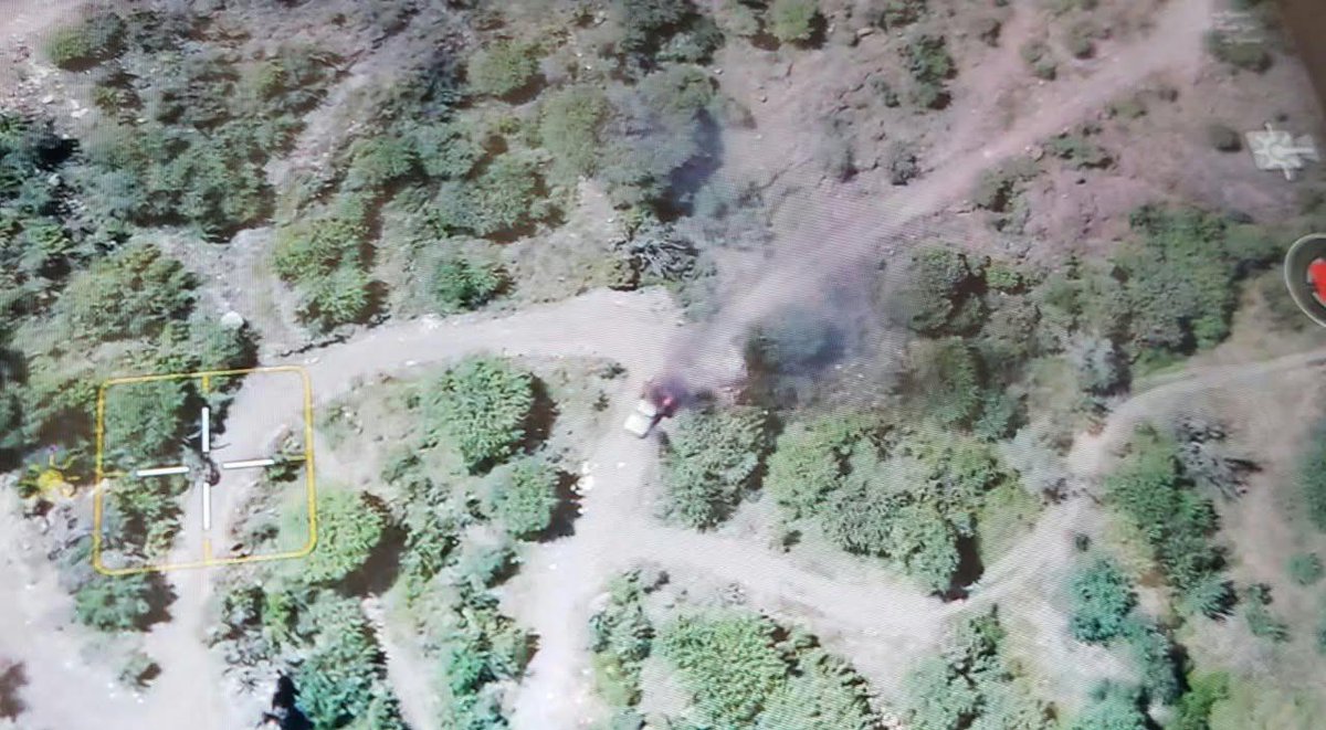
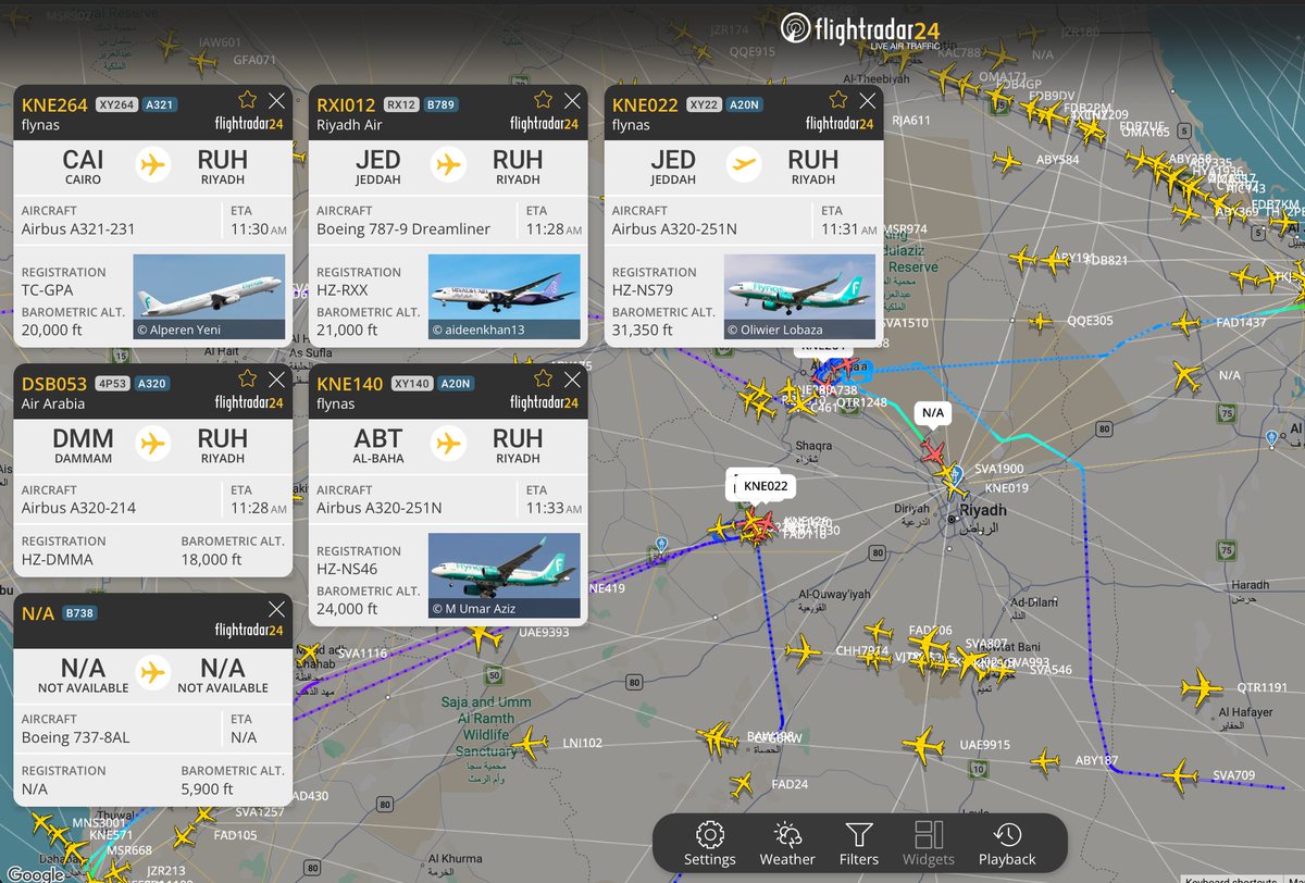
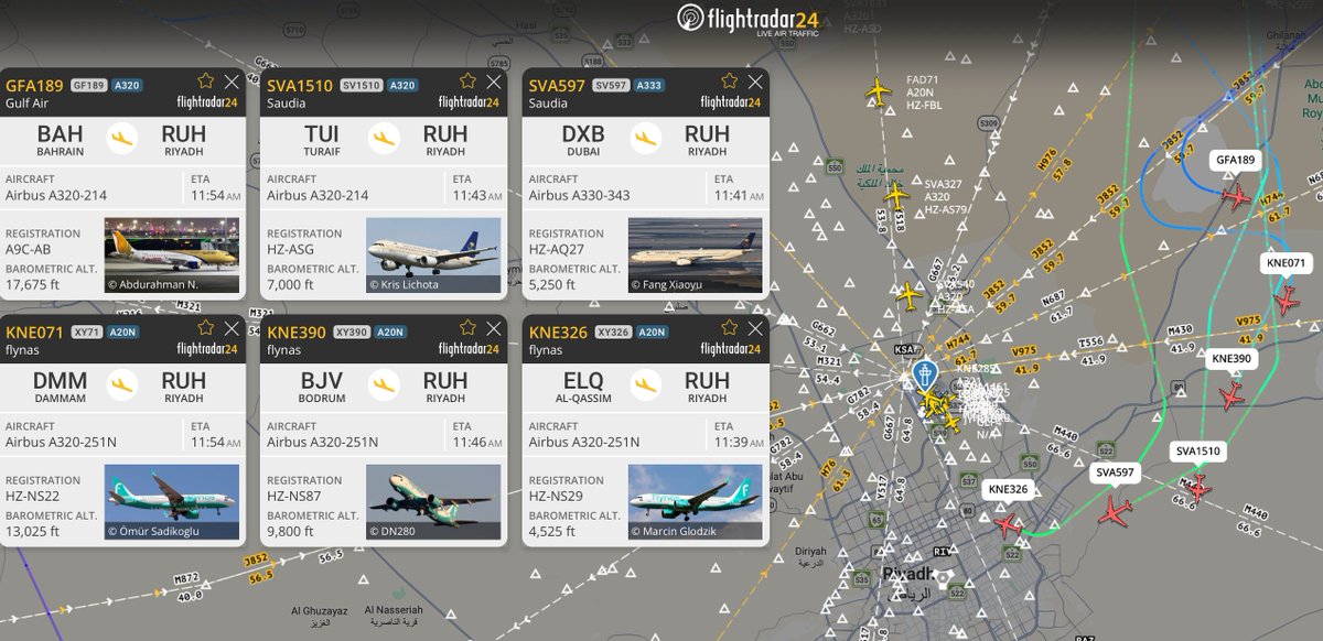
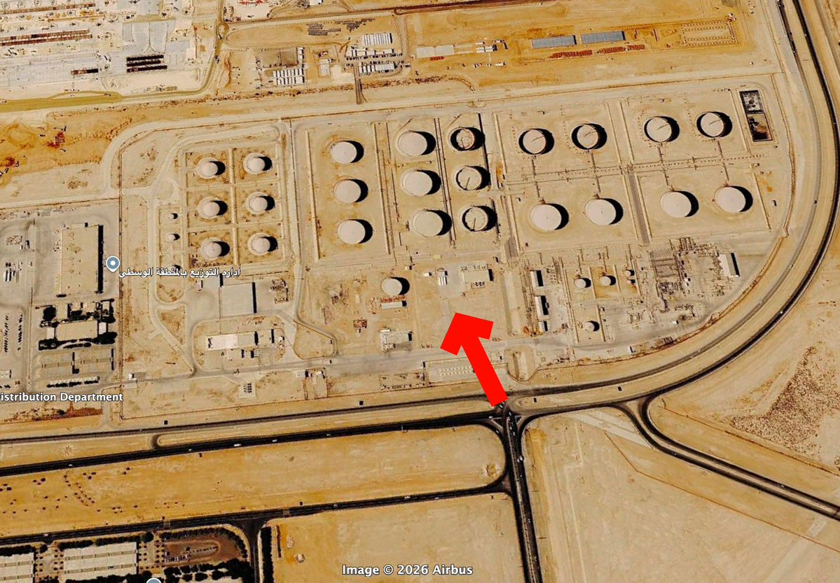
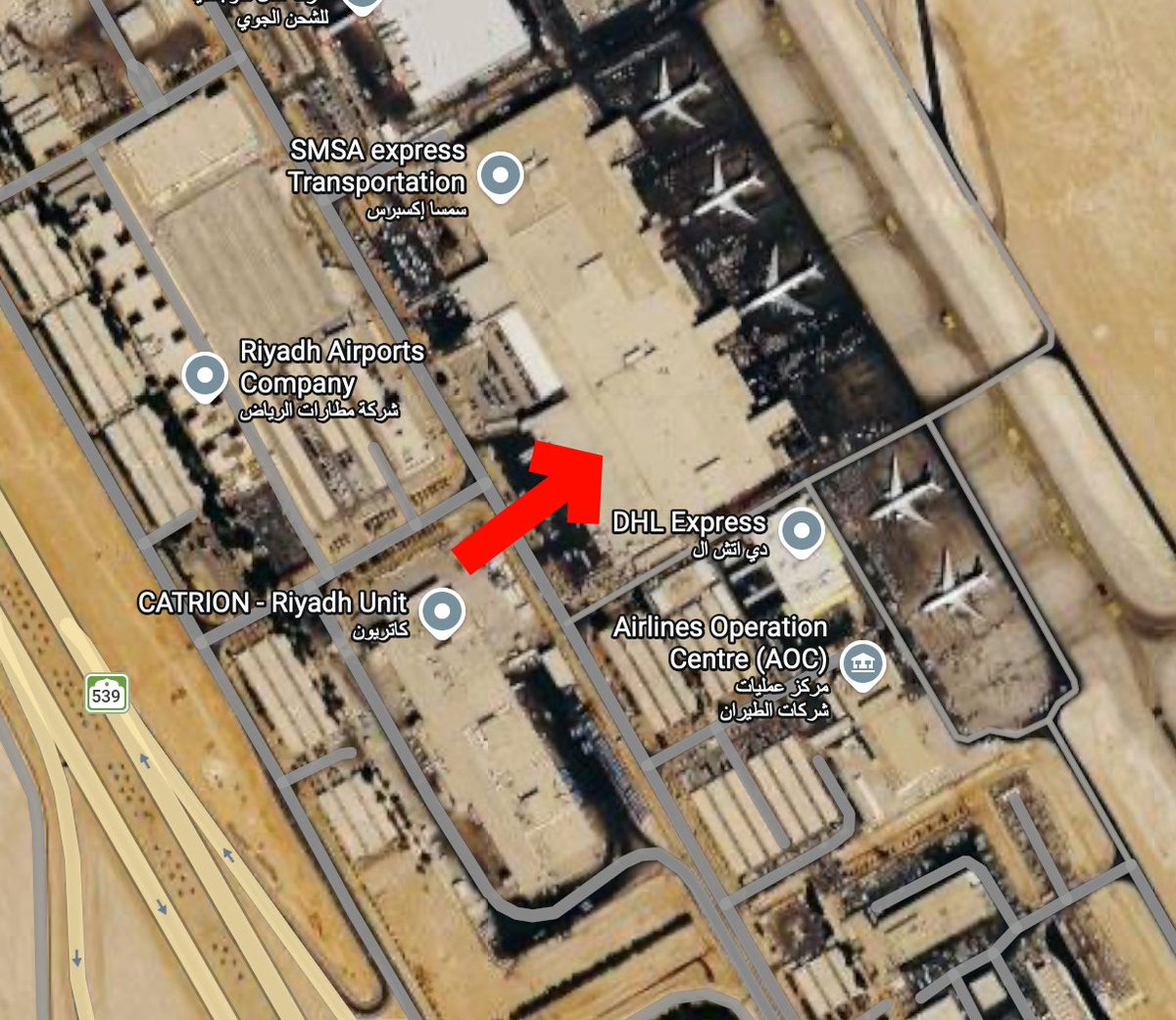
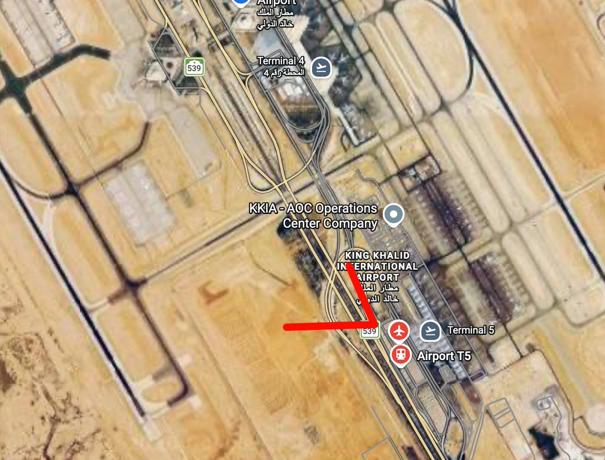
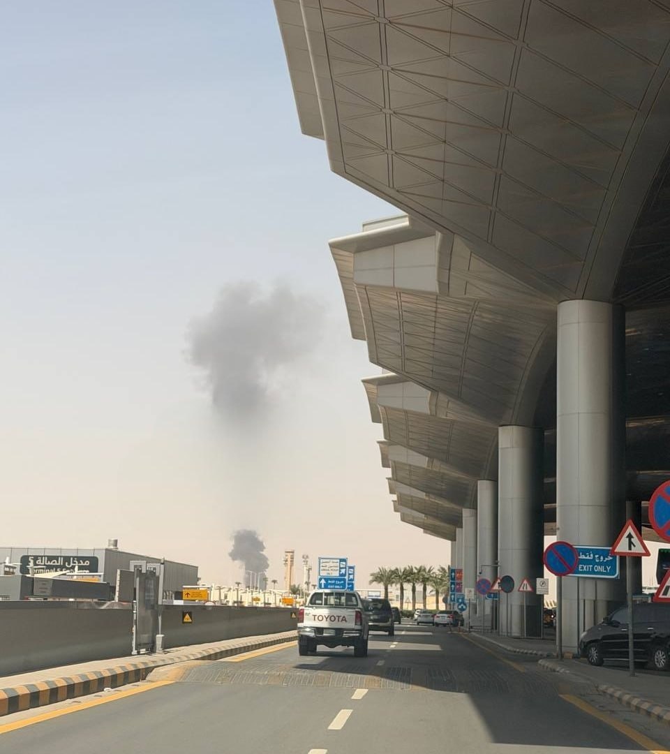
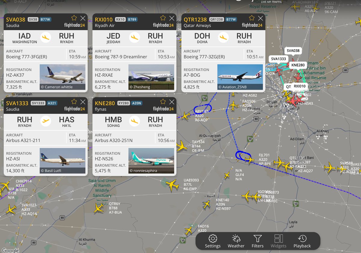
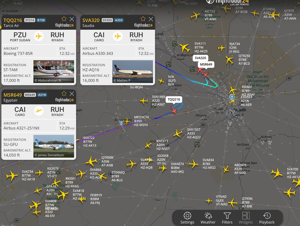
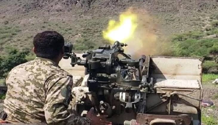
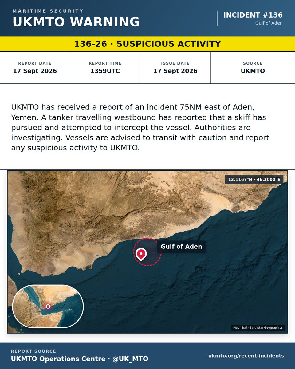


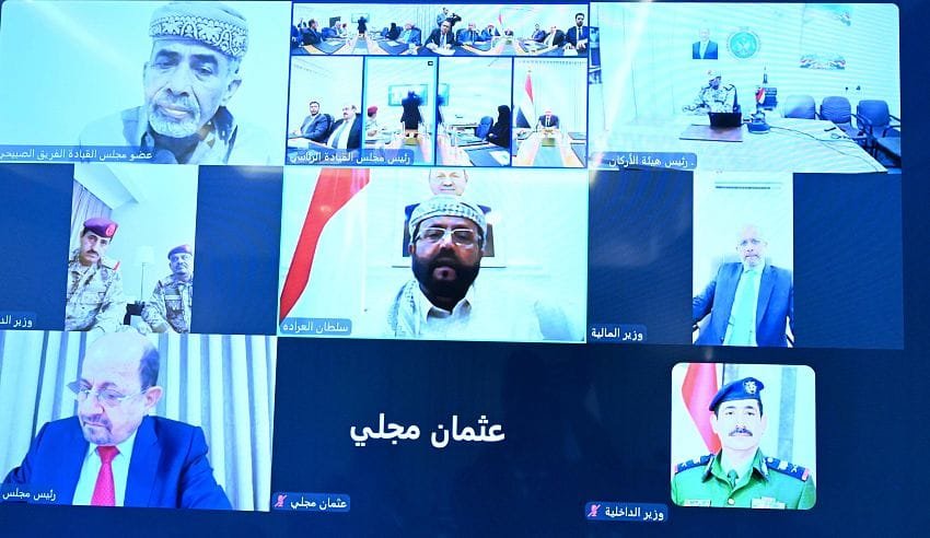
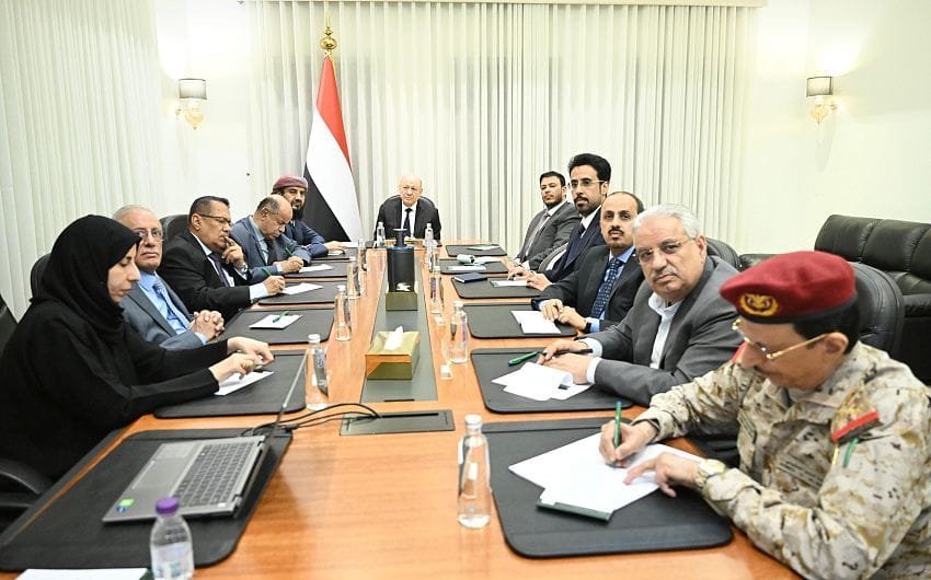
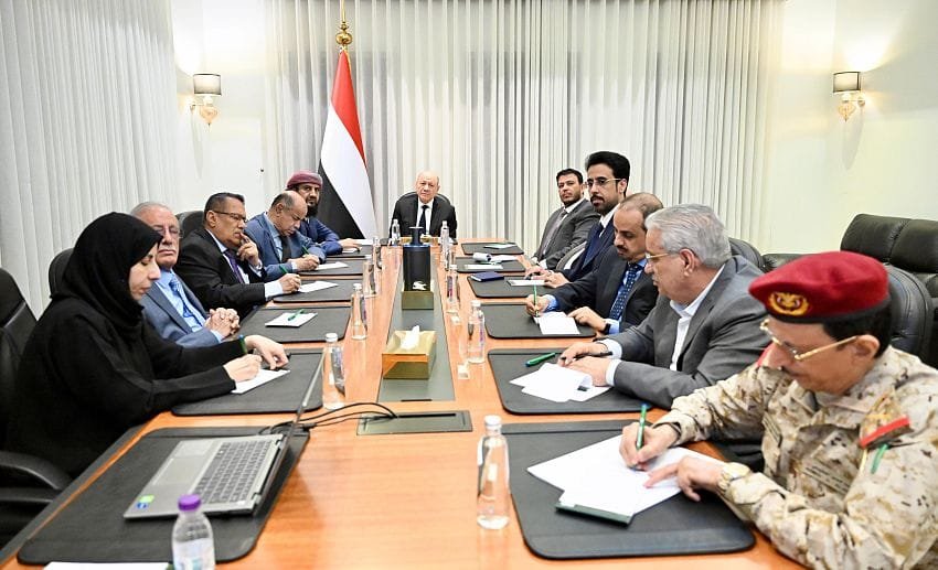
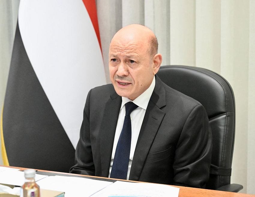
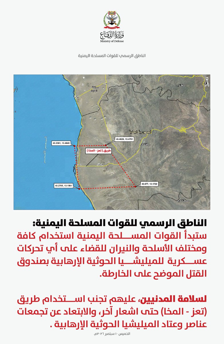
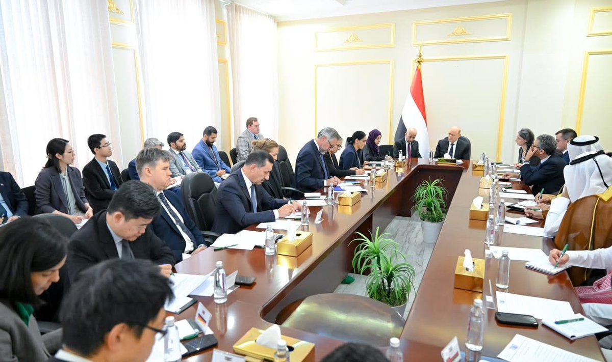
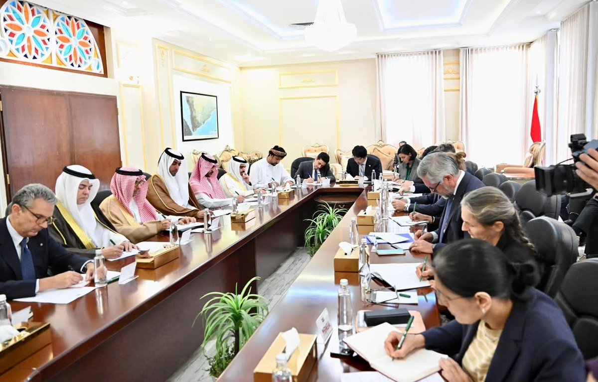
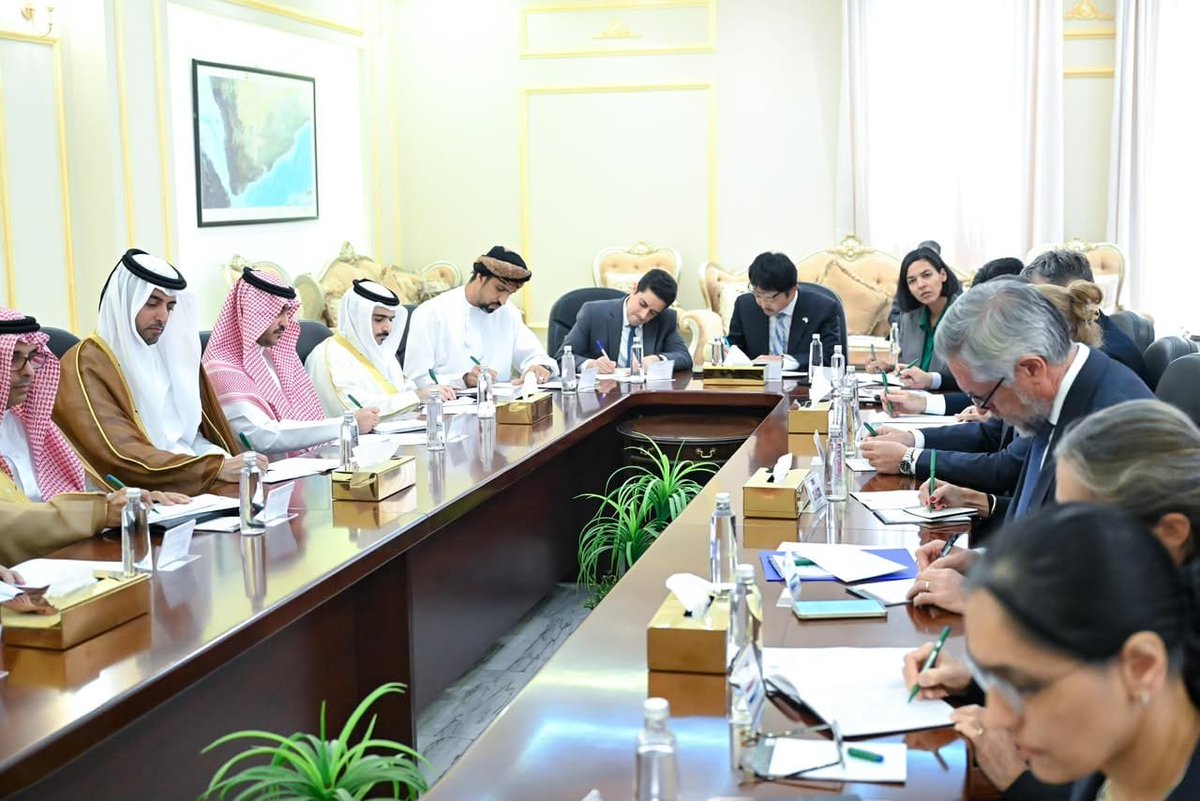

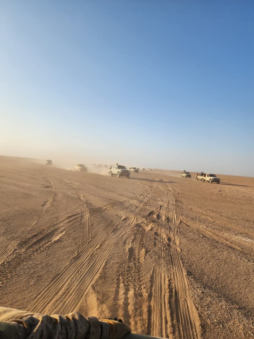

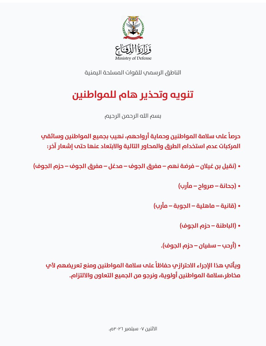

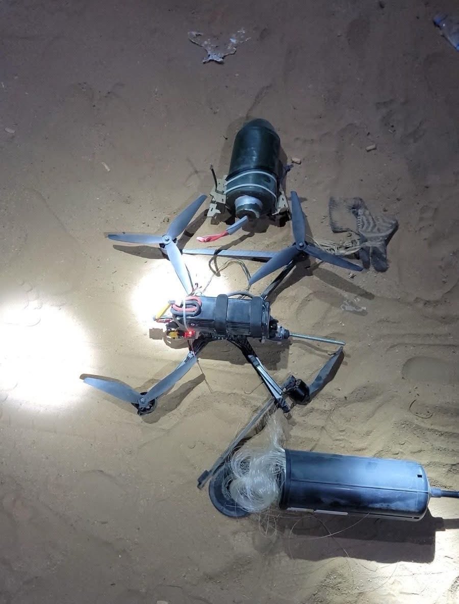
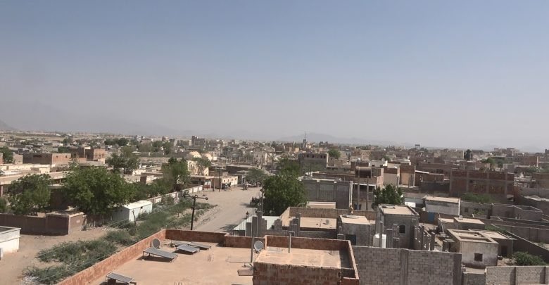
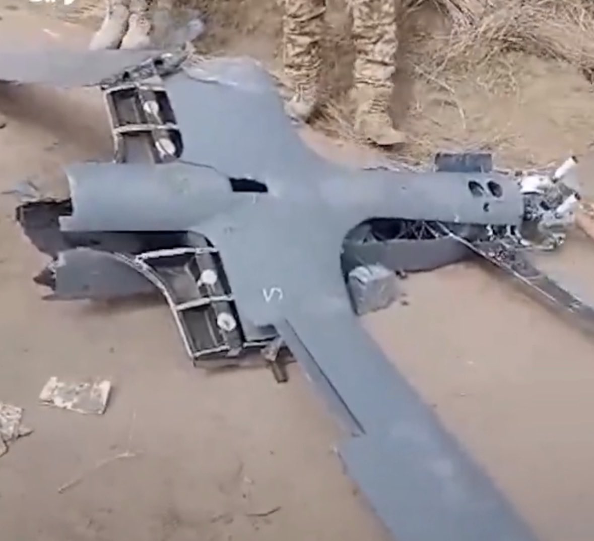

Discussion
Comments
No approved comments yet.