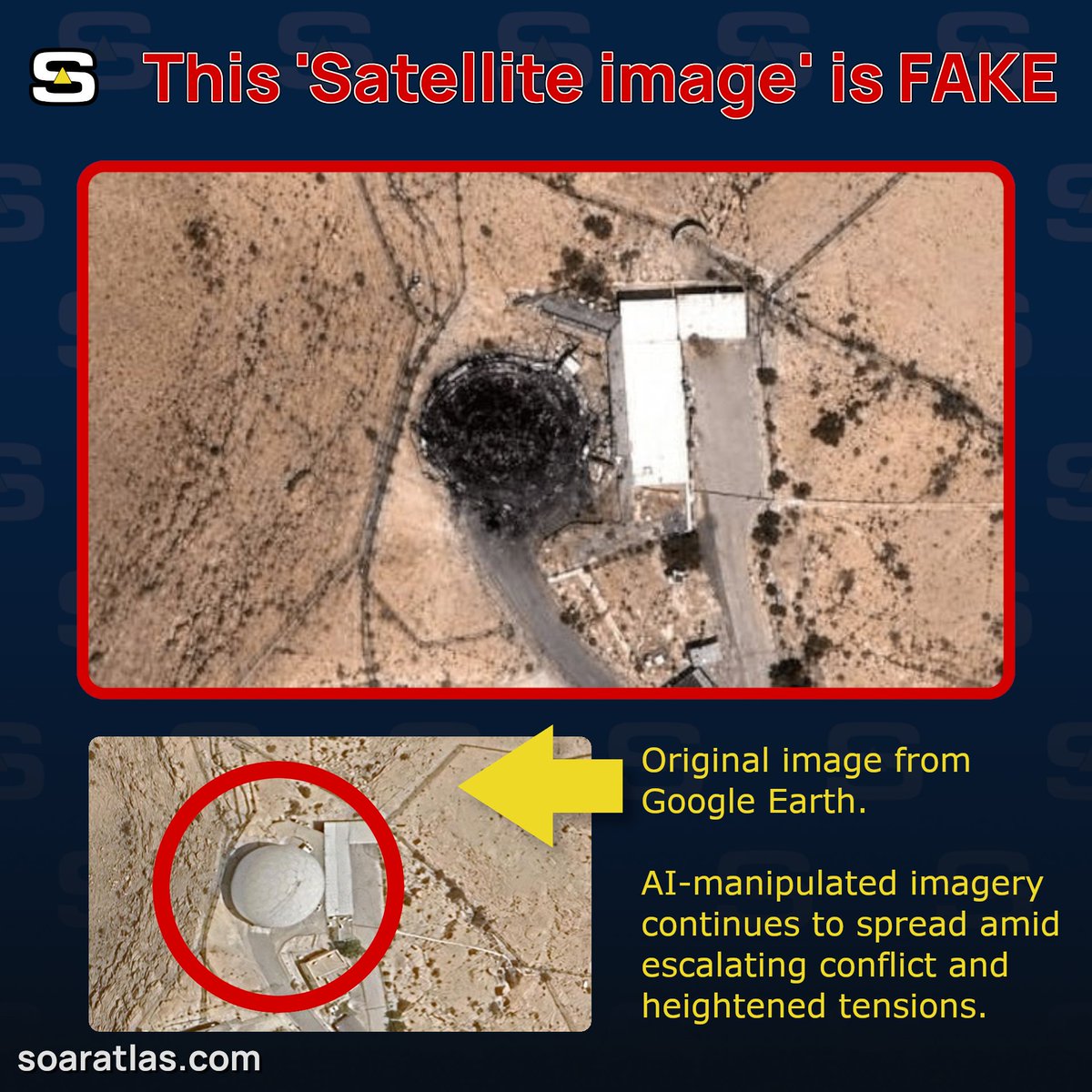
Shin (@hey_itsmyturn) shared a fact-check published by Soar Atlas (@SoarAtlas) about a viral image purporting to show an IRGC attack in Bahrain.
Soar Atlas wrote:
🚨🔍FACT CHECK: A new AI-generated satellite imagery has been going around, claiming that the IRGC destroyed a U.S. early-warning radar in Bahrain. During the height of the war, we often saw fakes like these spread rapidly. As tensions rise again, it won't be unexpected to see more.
The viral image is an AI-manipulated fake built on old Google Earth imagery. So how do we know what's real?
On Soar Atlas, you can explore independently verified imagery, compare real satellite observations and search for new imagery yourself. We manually review everything uploaded to the platform and try to put the power to verify the truth in people's hands.
Read our guide to spotting fake satellite imagery here:
https://about.soaratlas.com/blogs/fake-satellite-images
And next time you see a satellite image like this pop up, ask yourself... is this real?

Discussion
Comments
No approved comments yet.