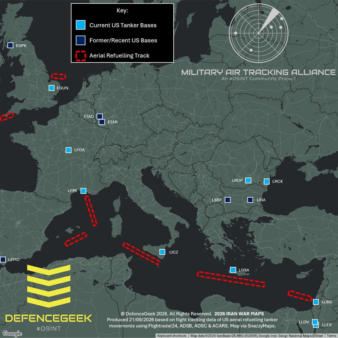
@hey_itsmyturn reposted an initial OSINT map by @DefenceGeek charting U.S. aerial refueling bases and general flight tracks across Europe and the Mediterranean.
The map covers routes used by KC-46A "Pegasus" and KC-135R/T "Stratotanker" aircraft. According to @DefenceGeek, these tracks supported fast-jet deployments into CENTCOM and bomber combat missions flown from RAF Fairford (EGVA) during the Iran War.
The post follows an earlier map focused on the Strait of Hormuz and the primary aerial refueling tracks used by tankers stationed in CENTCOM during the war and since the ceasefire.
@DefenceGeek cautioned that the map is a preliminary guide:
This is an initial version and is intended as a rough guide - some aircraft do not stick to these general areas and other areas may exist but haven't been included due to a lack of firm Open Source information.
The original post also tagged @MATA_osint.

Discussion
Comments
No approved comments yet.