Original document: Download the complete 19-page Arabic PDF
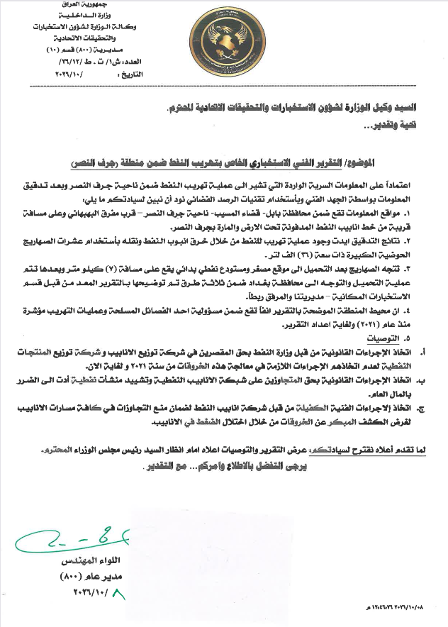
Cover letter
The first page bears the heading of the Republic of Iraq, Ministry of Defense, Office of the Deputy Minister for Intelligence and Security Investigations, and the Directorate General for Intelligence and Security. It is addressed to the Deputy Minister for Intelligence and Security Investigations and is headed “Issue and assessment.”
Subject: Special technical intelligence report on oil smuggling within the Jurf al-Nasr area
Based on incoming classified information indicating an oil-smuggling operation within Jurf al-Nasr subdistrict, and after the information was checked through technical means and space-based monitoring techniques, the letter states the following:
- The reported sites are in Babil Governorate, al-Musayyib District, Jurf al-Nasr subdistrict, near al-Bahbahani junction. They are close to the buried oil-pipeline route that passes through Jurf al-Nasr.
- The investigation confirmed oil smuggling through a breach in an oil pipeline, with the oil transported in dozens of large tanker trucks, each with a capacity of 36,000 liters.
- After loading, the tankers travel to a small refinery and a rudimentary covered depot approximately 7 kilometers away. Loading is then completed and the vehicles proceed to Baghdad Governorate along three routes described in the attached report prepared by the Directorate of Spatial Intelligence, identified in the letter as “our directorate.”
- The letter says the area described in the report falls under the responsibility of an armed faction and that smuggling activity has been observed since 2021 through the date of the report.
Recommendations in the cover letter
- The Ministry of Oil should take legal action against negligent personnel in the Oil Pipelines Company and the Oil Products Distribution Company for failing to take the measures required to address these breaches from 2021 to the present.
- Legal action should be taken against those encroaching on the oil-pipeline network and constructing oil installations that caused damage to public funds.
- The Oil Pipelines Company should take the necessary technical measures to prevent encroachments along all pipeline routes and enable early detection of breaches through pipeline pressure disruptions.
The closing says that, because of the report’s importance, it is proposed that the report and its recommendations be presented to the Prime Minister for information and for the necessary action. It ends with a request to review and issue instructions, followed by the signature and title of a major general/engineer serving as director general. The handwritten date is in October 2026.
Report title and contents
Special Technical Intelligence Report on Oil Smuggling within Jurf al-Nasr
The report’s table of contents lists:
- Introduction — page 2
- Purpose — page 2
- Incoming intelligence and investigation results — page 2
- Oil-smuggling routes to Baghdad Governorate — page 14
- Analytical maps for the file — page 16
- Analysis and conclusions — page 18
- Summary — page 18
Every internal page is marked “Top Secret.” The page footers use the format “(19 – page number).”
1. Introduction
Relying on incoming classified information and intelligence-verification programs, and through continuous monitoring and intensified intelligence work tracking tanker movements along the Iraqi Ministry of Oil’s pipeline route within Jurf al-Nasr, the reported information was cross-checked against databases and examined with specialized programs. This report was then prepared.
2. Purpose
The purpose is to examine tanker movements within Jurf al-Nasr and their relationship to reported breaches along the oil-pipeline route extending through the Jurf area, and to identify the possible economic and financial effect of those breaches on federal government decisions.
3. Incoming intelligence and investigation results
A. First reported coordinate: 38SMB2897228756
The incoming coordinate 38SMB2897228756 is located in Babil Governorate, al-Musayyib District, Jurf al-Nasr subdistrict, approximately 1 kilometer from al-Bahbahani junction and 4 kilometers from the Baghdad–Babil road. The information alleges an oil-smuggling operation.
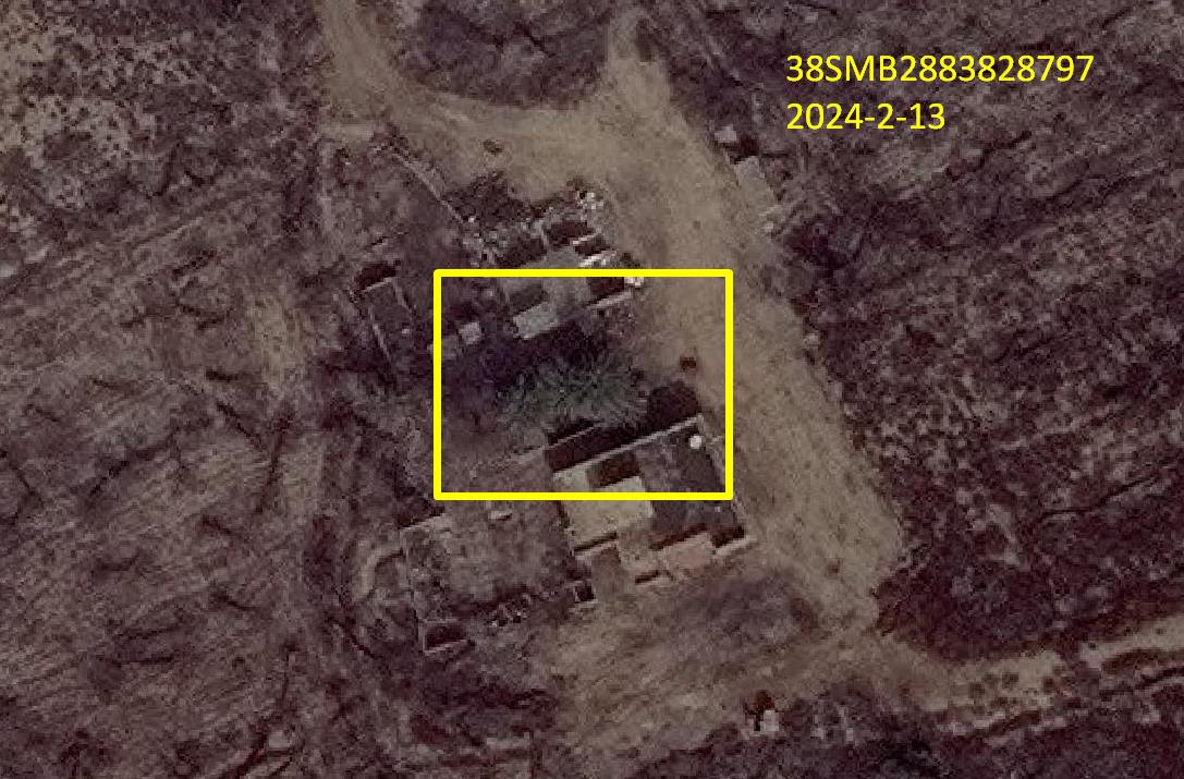
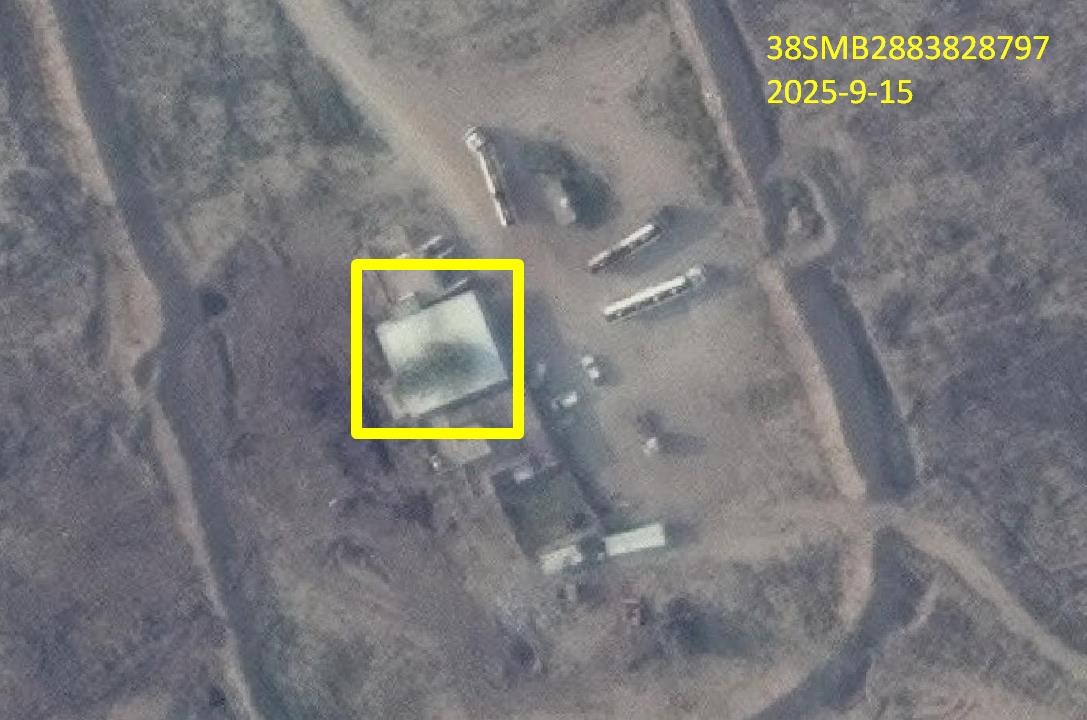
#### First site: 38SMB2883828797
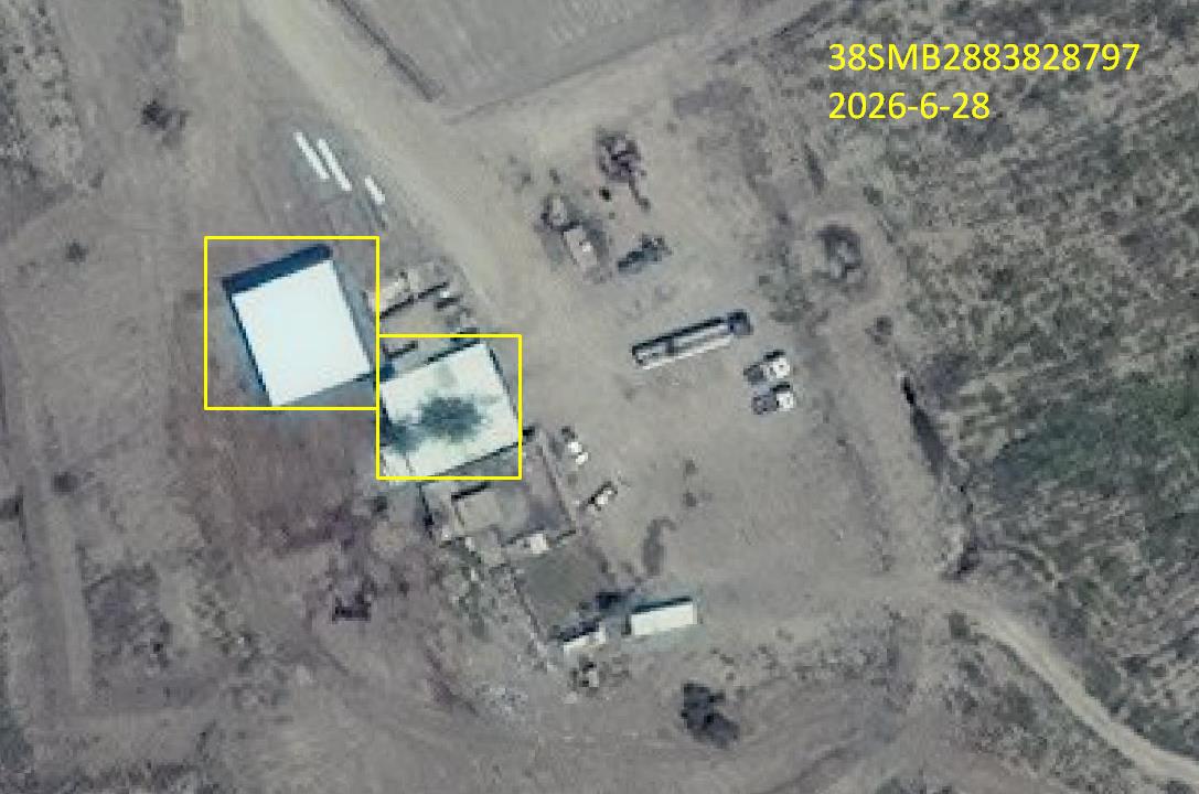
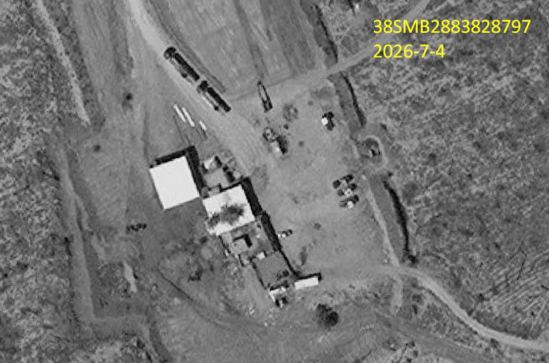
Geospatial examination around the reported coordinate identified a site at 38SMB2883828797, approximately 138 meters away. In 2024, the site contained two houses with palm trees between them. Follow-up imagery showed the palm-tree area covered with white-colored metal, with 36,000-liter tankers repeatedly traveling to the site.
- The report assesses that the breach in the oil pipeline extending through Jurf al-Nasr may be at 38SMB2914528645.
- The nearest distance from coordinate 38SMB2883828797 to the oil pipeline crossing the area is 342 meters.
- The report says it could not determine whether the loaded product was crude oil or refined petroleum products.
Observed 36,000-liter tankers at the first site
- February 13, 2024: 0 tankers.
- September 15, 2025: 3 tankers.
- June 28, 2026: 1 tanker.
- July 4, 2026: 2 tankers.
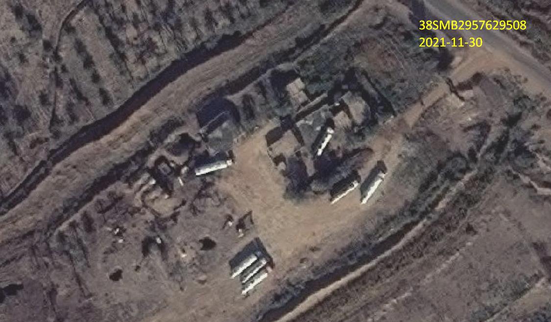
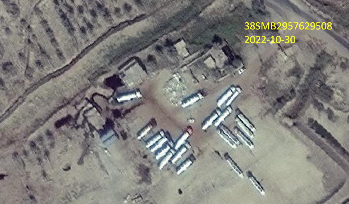
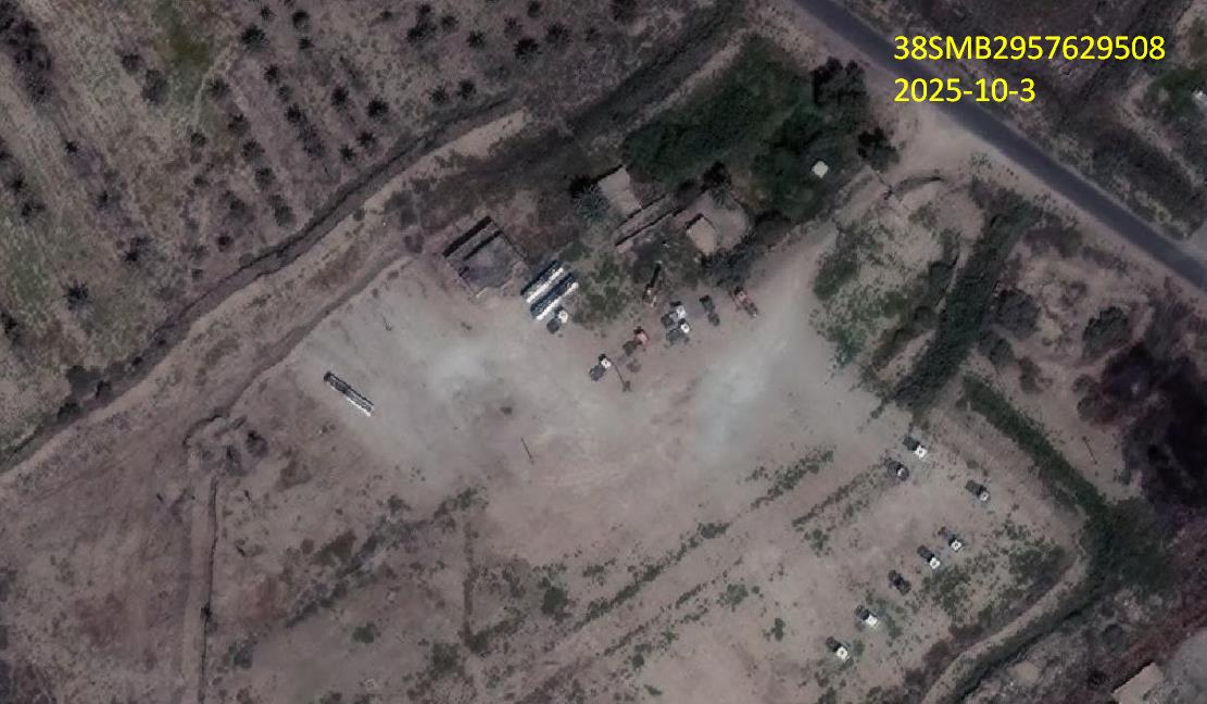
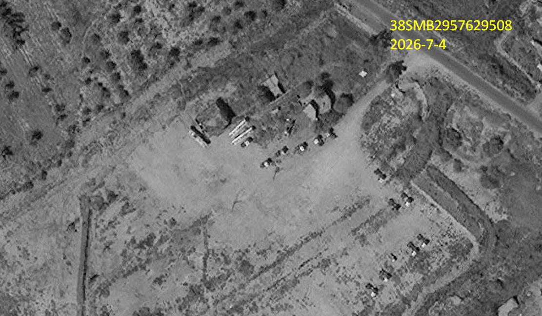
#### Second site: 38SMB2957629508
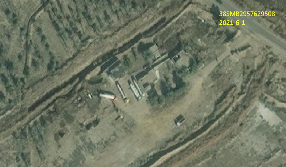
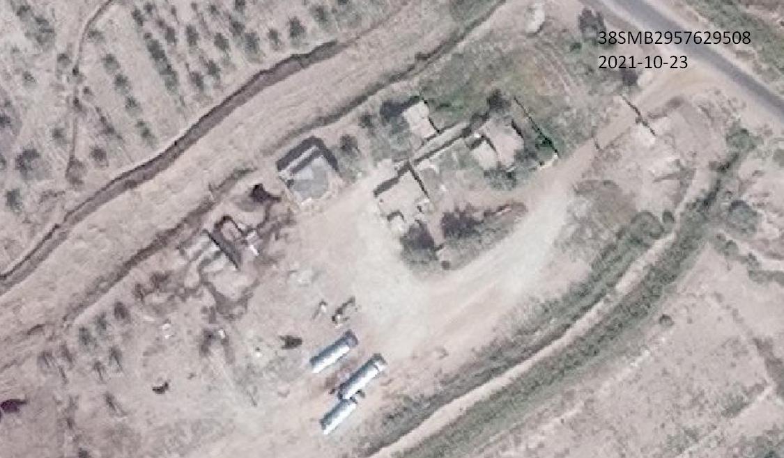
The report says a second site was identified around the same incoming coordinate at 38SMB2957629508, approximately 964 meters away. It describes a pit in the ground containing oil stains, with tanker trucks nearby at different times beginning in 2021.
- The nearest distance from this coordinate to the oil pipeline crossing the area is 962 meters.
- The report again says it could not determine whether the loaded product was crude oil or refined petroleum products.
Observed 36,000-liter tankers at the second site
- June 1, 2021: 4 tankers.
- October 23, 2021: 3 tankers.
- November 30, 2021: 7 tankers.
- October 30, 2022: 21 tankers.
- October 3, 2025: 3 tankers.
- July 4, 2026: 3 tankers.
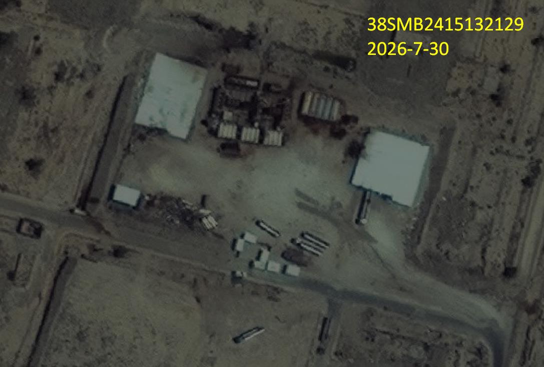
B. Second reported coordinate: 38SMB2415132129
The incoming coordinate 38SMB2415132129 is in Babil Governorate, al-Musayyib District, Jurf al-Nasr subdistrict, approximately 7 kilometers from al-Bahbahani junction and 11 kilometers from the Baghdad–Babil road. The information alleges an oil-smuggling operation.
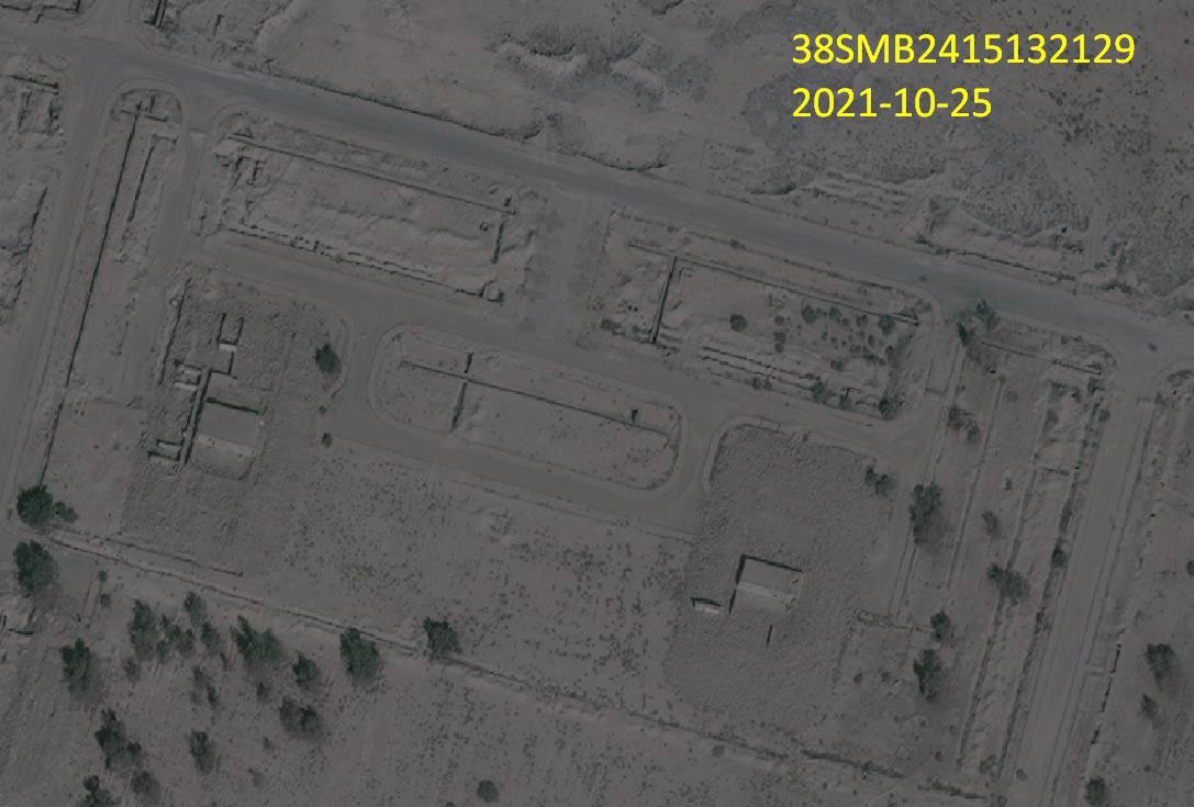
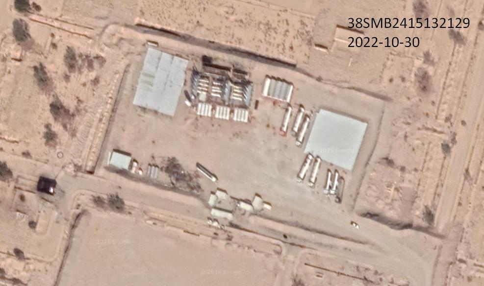
Geospatial examination found no activity at the coordinate on October 25, 2021. Approximately one year later, on October 30, 2022, tanker trucks were observed stopping at a site that, based on the infrastructure visible in the imagery, appeared to be a small oil refinery with limited refining capability.
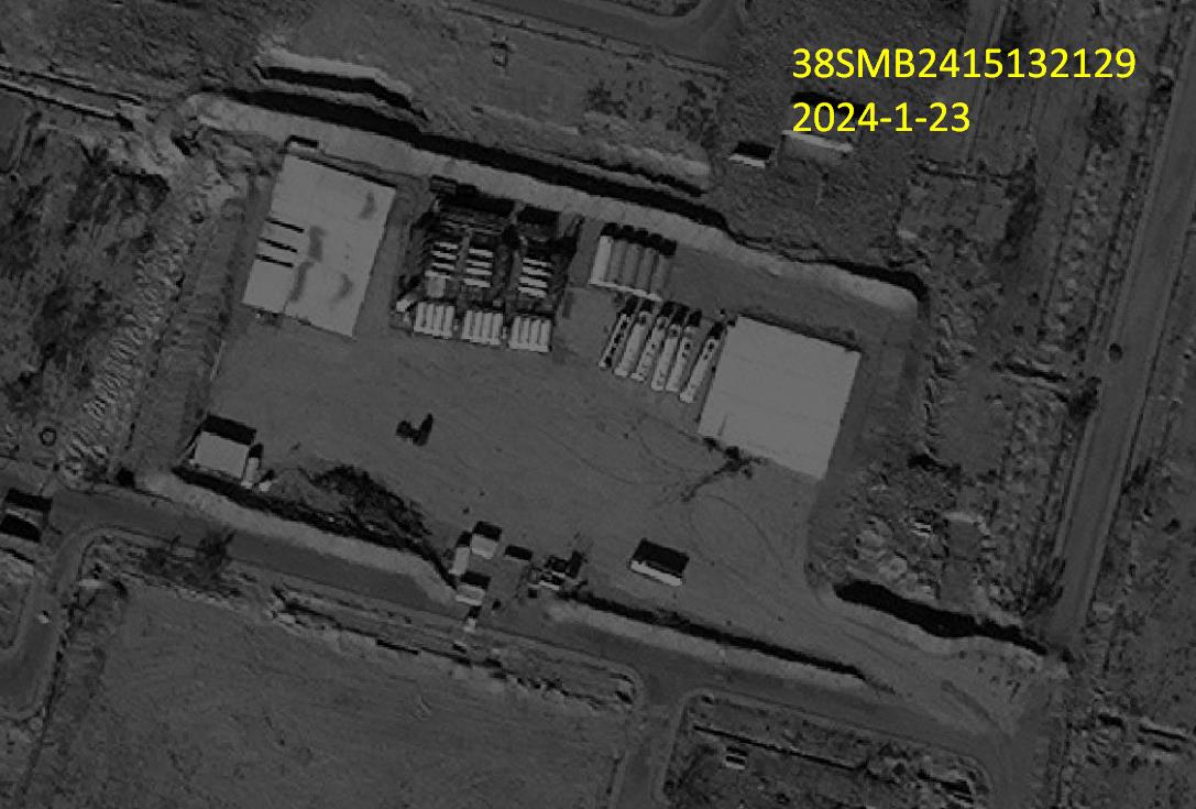
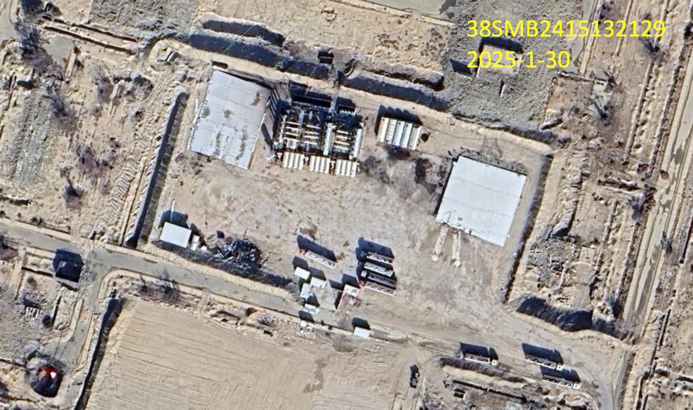
Observations at coordinate 38SMB2415132129
- October 25, 2021: site under construction.
- October 30, 2022: 9 tankers.
- January 23, 2024: 7 tankers.
- January 30, 2025: 8 tankers.
- July 30, 2026: 6 tankers.
#### Additional site: 38SMB2407931433
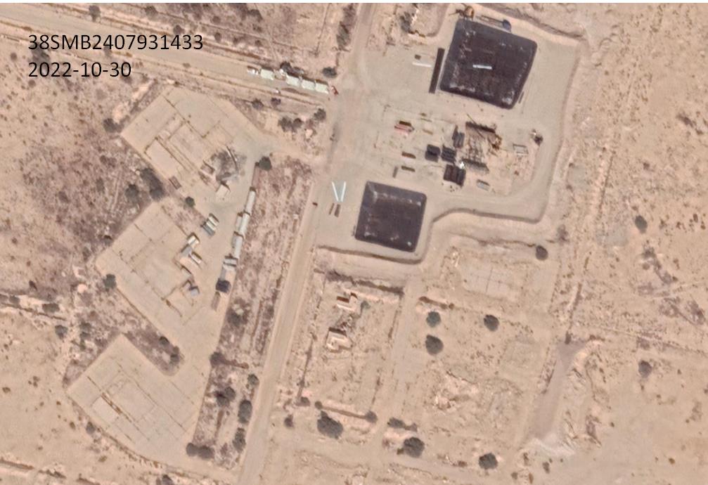
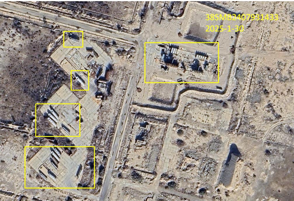
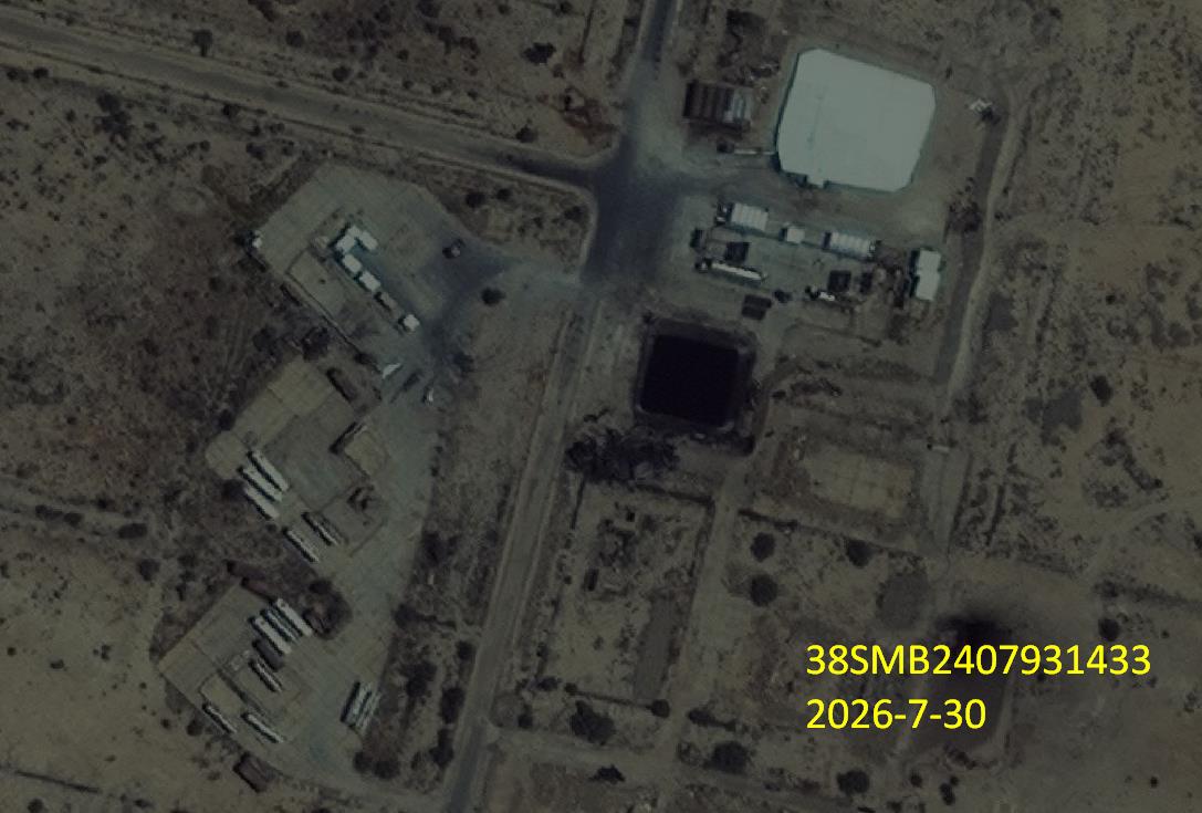
As a continuation of the preceding finding, the report says that a site approximately 700 meters away at 38SMB2407931433 showed the construction of new oil installations and tanker trucks stopping during the same period.
Observations at coordinate 38SMB2407931433
- October 30, 2022: oil refinery under construction.
- January 30, 2025: 14 tanker trucks, each with a capacity of 36,000 liters, stopped near the refinery after its completion.
- July 30, 2026: 14 tanker trucks, each with a capacity of 36,000 liters, stopped at the site; the oil pits had been covered with a white metal structure.
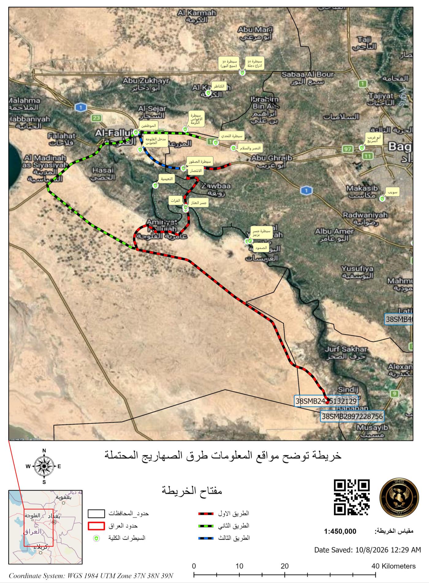
4. Oil-smuggling routes to Baghdad Governorate
Route one
The report says the tankers loading oil could travel to the Baghdad–Babil road, then cross al-Musayyib Bridge and continue to Baghdad Governorate.
Route two
The tankers could leave the refinery area described in section 3-B toward Amiriyat al-Fallujah and merge with tanker traffic heading to fuel stations in Amiriyah. They would cross the Euphrates River at the al-Anaz Bridge checkpoint, reach the international highway, pass through the al-Intisar checkpoint, and continue toward Baghdad Governorate. This route is shown in red on the map.
Route three
The tankers could leave the same refinery area toward Amiriyat al-Fallujah, continue toward al-Habbaniyah, then travel to Fallujah, cross the river, and reach a junction with two routes toward Baghdad Governorate: the first via the international highway and the second via the old road leading to Abu Ghraib. These branches are shown in green and blue on the map.
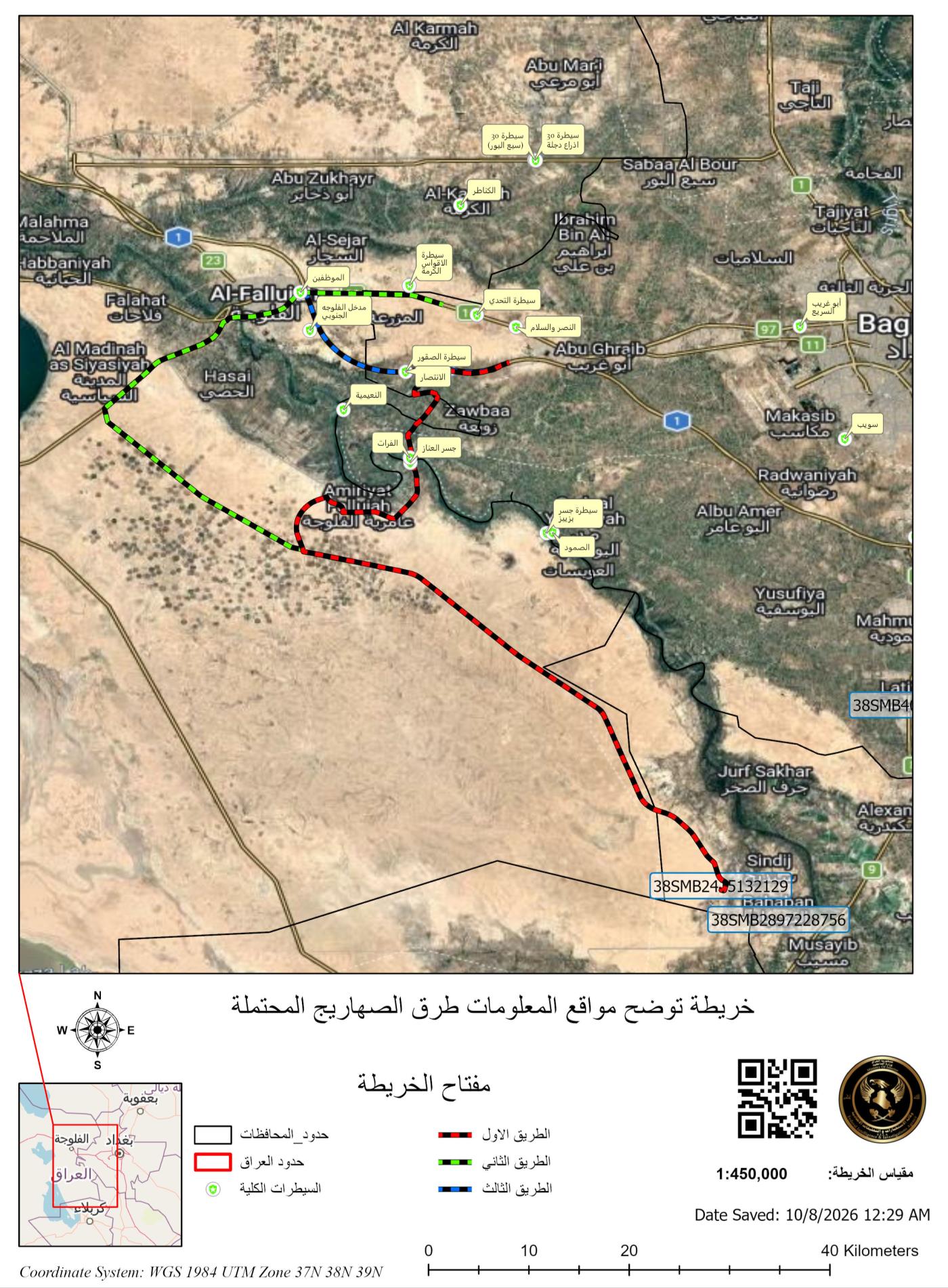
The route map’s legend identifies the first, second, and third routes; governorate boundaries; Iraq’s international boundary; and security checkpoints. It gives a scale of 1:450,000, states that it was saved on October 8, 2026, at 12:29 a.m., and lists the coordinate reference as WGS 1984 UTM Zones 37N, 38N, and 39N.
5. Analytical maps
Map showing the reported information sites
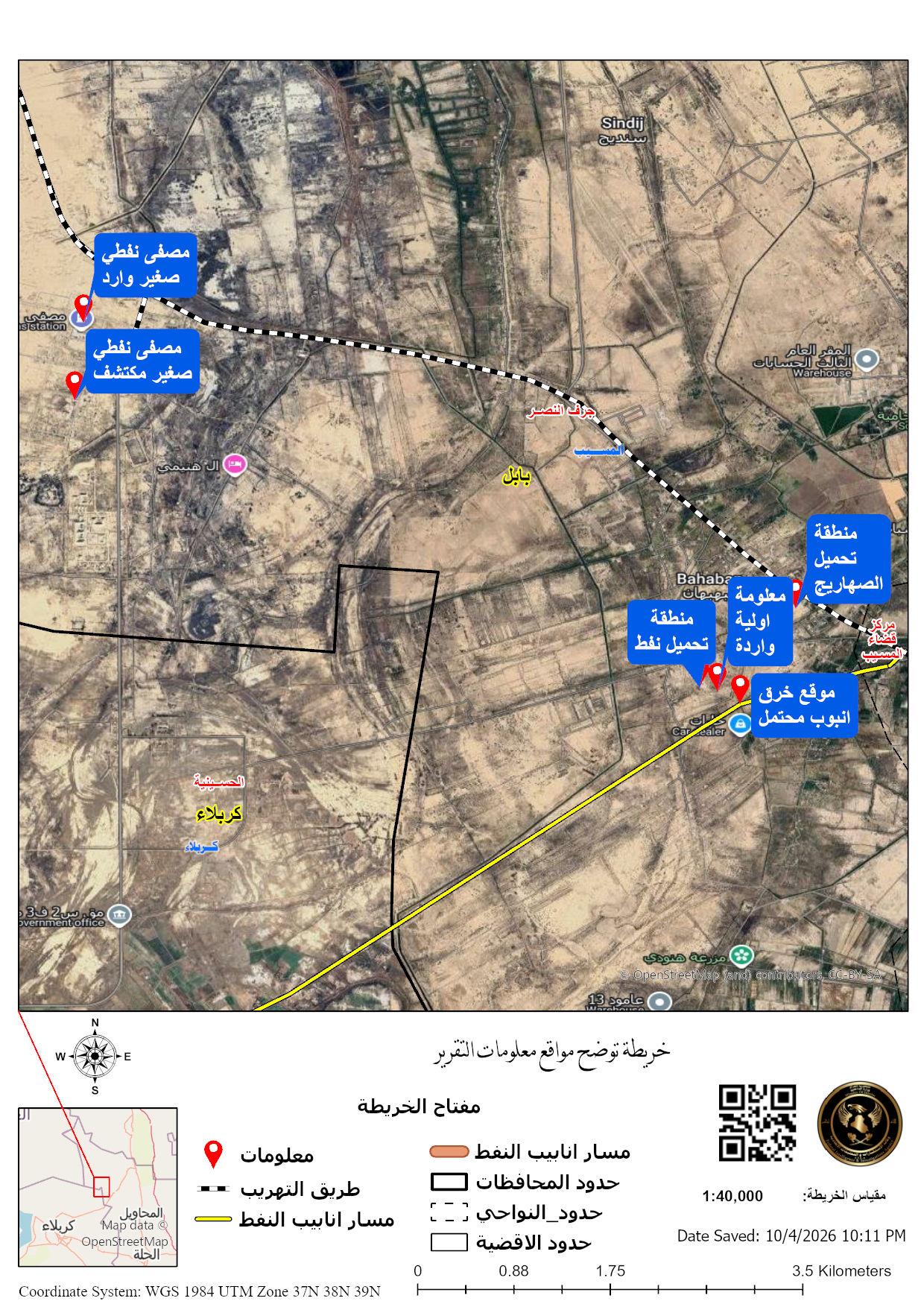
The map legend identifies the oil-pipeline route, reported information sites, Iraq’s international boundary, governorate boundaries, and district boundaries. The labels identify the suspected first pipeline-breach point, the reported first site, the reported second site, an oil refinery, a warehouse, and checkpoints. The map gives a scale of 1:25,000, states that it was saved on October 5, 2026, at 10:11 p.m., and lists WGS 1984 UTM Zones 37N, 38N, and 39N.
Map showing the coordinates
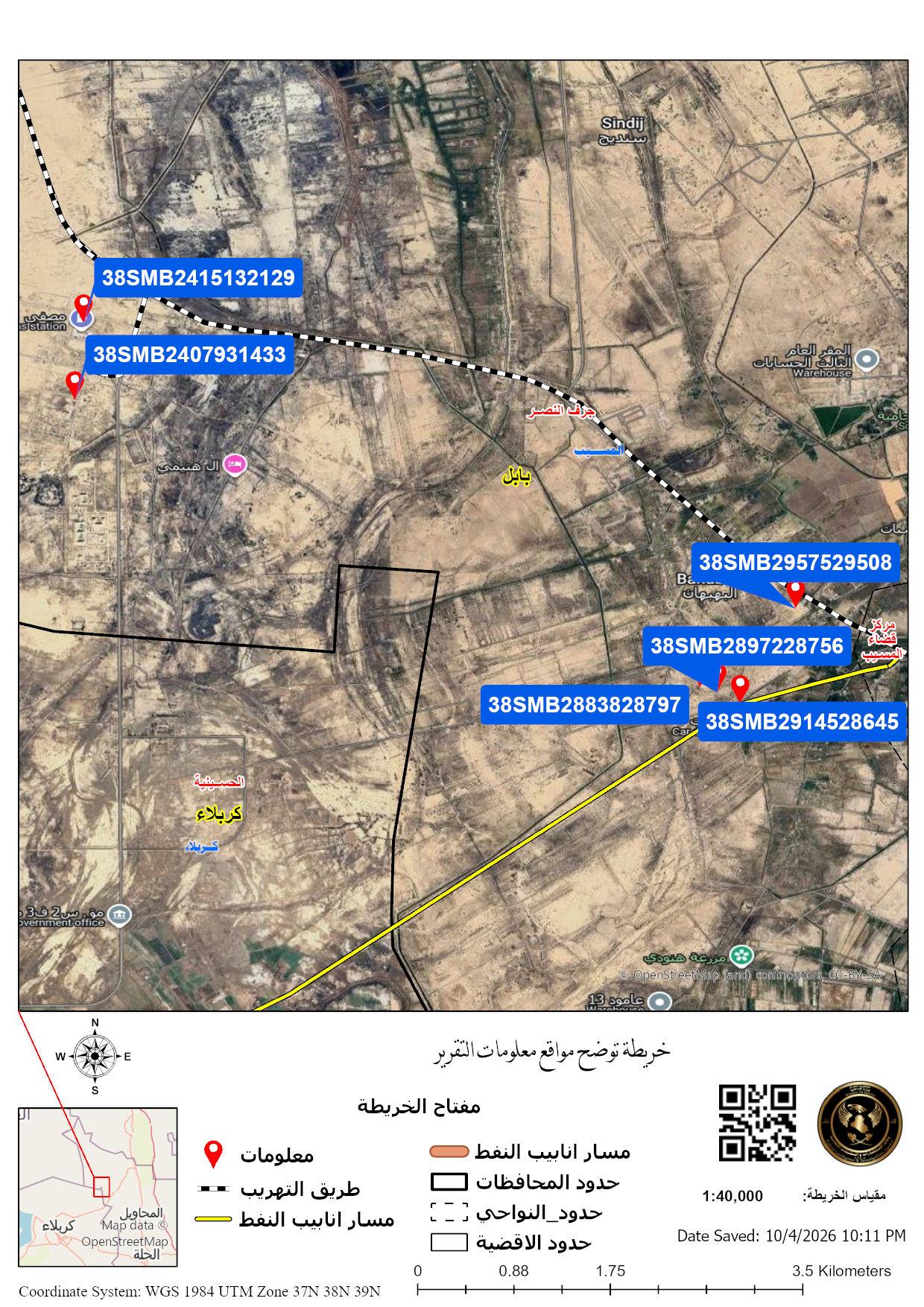
The coordinate map plots the report’s sites and pipeline corridor. Its legend identifies the oil-pipeline route, report information, smuggling sites, governorate boundaries, subdistrict boundaries, and district boundaries. It states that it was saved on October 4, 2026, at 10:11 p.m. and lists WGS 1984 UTM Zones 37N, 38N, and 39N.
6. Analysis and conclusions in the report
- The report says coordinate 38SMB2957629508, observed through technical means, shows frequent loading from a breach site near the oil-pipeline route. Monitoring recorded 21 tanker trucks during 2022, while loading activity declined in later years.
- Coordinate 38SMB2883828797, observed through technical means, is described as the location of the first pipeline breach and as an active site during 2025–2026, according to satellite imagery.
- The imagery at reported coordinate 38SMB2415132129 is said to show underground pits covered by a white metal structure and used to store oil instead of visible above-ground petroleum storage facilities.
- The report says it is necessary to identify recorded pressure disruptions in the oil pipelines extending through Jurf al-Nasr, specifically at the report’s sites of interest, using Ministry of Oil data, and compare those disruptions with the periods shown in the tables and images in section 3-A.
- The recorded tanker counts were collected during daylight hours. The report says the information indicates loading continues during the night, which would increase the volume of oil smuggling and point to severe losses and clear damage to the country’s oil sector.
7. Summary in the report
Oil smuggling is still continuing within Jurf al-Nasr because the area is under the control and protection of an armed faction. We propose strengthening the information with Ministry of Oil data indicating pressure disruptions in the oil pipelines extending through Jurf al-Nasr.
End of report.
Discussion
Comments
No approved comments yet.